|
search place name
|
||
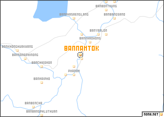
Ban Nam Tok (Surat Thani, Thailand)Ban Nam Tok is a town in the Surat Thani region of Thailand. An overview map of the region around Ban Nam Tok is displayed below.
regional and 3d topo map of Ban Nam Tok, Thailand ::
Ban Nam Tok airports ::
The nearest airport is HKT - Phuket Intl, located 100.4 km south west of Ban Nam Tok.
Other airports nearby include NST - Nakhon Si Thammarat Cha Ian (128.7 km east), TST - Trang (170.7 km south east), HDY - Songkhla Hat Yai Intl (271.8 km south east), Nearby towns ::
Ban Pa Kuat (0.0km north) //
Ban Yan Loet (0.0km north) //
Ban Phang Kan Nua (1.9km north) //
Ban Bang Yuan (2.6km south west) //
Ban Bang Pho (2.6km south west) //
Phanom (4.1km south west) //
Ban Khao Wong (4.1km north east) //
Ban Hua Ling (5.2km south west) //
Ban Pak Suat (5.6km north) //
Ban Yan Lon (6.7km north east) //
Ban Hat Kok (7.8km north east) //
[all distances 'as the bird flies' and approximate] 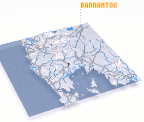 Places with similar names to Ban Nam Tok, Thailand ::
// Ban Mae Tak (TH)
// Ban Mae Toei (2) (TH)
// Ban Mat Ka (TH)
// Ban Mat Ok (TH)
// Ban Nam Duk (TH)
// Ban Nam Tok (TH)
// Ban Nam Tok (TH)
// Ban Nam Tok (TH)
// Ban Nam Tok (TH)
// Ban Nam Tok (TH)
Disclaimer :: Information on this page comes without warranty of any kind |
||
|
Where is Ban Nam Tok? Elevation and coordinates ::
Latitude (lat): 8°51'0"N Longitude (lon): 98°51'0"E
Elevation (approx.): 39m (map arrows pan, magnifying glasses zoom) |
||
|
Visiting Ban Nam Tok? Hotel/Accommodation ::
Book a hotel in Ban Nam Tok Travel Guide ::
Buy a travel guide for Thailand rental cars ::
car rental offers GPS waypoint ::
download a GPX waypoint (PoI) of Ban Nam Tok for your GPS receiver
|
||