|
search place name
|
||
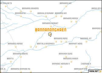
Ban Na Nong Haen (Phetchabun, Thailand)Ban Na Nong Haen is a town in the Phetchabun region of Thailand. An overview map of the region around Ban Na Nong Haen is displayed below.
regional and 3d topo map of Ban Na Nong Haen, Thailand ::
Ban Na Nong Haen airports ::
The nearest airport is PHS - Phitsanulok, located 73.5 km north west of Ban Na Nong Haen.
Other airports nearby include LOE - Loei (165.7 km north east), NAK - Nakhon Ratchasima Khorat (207.6 km south east), PRH - Phrae (213.4 km north), LPT - Lampang (255.9 km north west), Nearby towns ::
Ban Wang Khoi (2.6km south east) //
Ban Wang Kradat (3.7km north) //
Ban Ta Luang Phon (4.1km south west) //
Ban Wang Pong (4.0km south east) //
Ban Wang Chumnum (5.6km east) //
Ban Kon Chanang (5.6km west) //
Ban Dan Chang (6.5km south west) //
Ban Khlong Phap (7.6km north) //
Ban Nam Om (7.6km north) //
Ban Phai Tang (1) (8.0km south west) //
Ban Wang Hin (8.2km north east) //
Ban Khok Sung (9.1km south east) //
Ban Wang Pong (1) (9.0km north east) //
[all distances 'as the bird flies' and approximate]  Places with similar names to Ban Na Nong Haen, Thailand :: Disclaimer :: Information on this page comes without warranty of any kind |
||
|
Where is Ban Na Nong Haen? Elevation and coordinates ::
Latitude (lat): 16°17'0"N Longitude (lon): 100°44'0"E
Elevation (approx.): 87m (map arrows pan, magnifying glasses zoom) |
||
|
Visiting Ban Na Nong Haen? Hotel/Accommodation ::
Book a hotel in Ban Na Nong Haen Travel Guide ::
Buy a travel guide for Thailand rental cars ::
car rental offers GPS waypoint ::
download a GPX waypoint (PoI) of Ban Na Nong Haen for your GPS receiver
|
||