|
search place name
|
||
Ban Na Som (Nakhon Phanom, Thailand)Ban Na Som is a town in the Nakhon Phanom region of Thailand. An overview map of the region around Ban Na Som is displayed below.
regional and 3d topo map of Ban Na Som, Thailand ::

Ban Na Som airports ::
The nearest airport is SNO - Sakon Nakhon, located 35.8 km south of Ban Na Som.
Other airports nearby include ZVK - Savannakhet (128.3 km south east), UTH - Udon Thani (138.3 km west), VTE - Vientiane Wattay Intl (169.4 km west), Nearby towns ::
Ban Muang (1.9km south) //
Ban Sieo (3.7km north) //
Na Wa (4.1km south east) //
Ban Don Daeng (5.6km west) //
Ban Men (5.6km west) //
Ban Lao (5.8km north) //
Ban Don Po (7.6km north) //
Ban Na Muang (7.7km north west) //
Ban Na Som (8.2km south west) //
King Amphoe Na Wa (8.2km south west) //
Ban Na Ngua (8.2km south east) //
Ban Nong Bua (8.0km south east) //
Ban Don Sala (9.1km north east) //
Ban Na Pho (10.2km south east) //
[all distances 'as the bird flies' and approximate] 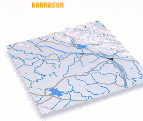 Places with similar names to Ban Na Som, Thailand ::
// Ban Na Sam (TH)
// Ban Na Sam (TH)
// Ban Na Som (TH)
// Ban Na Som (TH)
// Ban Na Sum (TH)
// Ban Sa-iam (TH)
// Ban Sai Ma (TH)
// Ban Sai Mai (TH)
// Ban Sam (TH)
// Ban Sam (TH)
Disclaimer :: Information on this page comes without warranty of any kind |
||
|
Where is Ban Na Som? Elevation and coordinates ::
Latitude (lat): 17°31'0"N Longitude (lon): 104°5'0"E
Elevation (approx.): 148m (map arrows pan, magnifying glasses zoom) |
||
|
Visiting Ban Na Som? Hotel/Accommodation ::
Book a hotel in Ban Na Som Travel Guide ::
Buy a travel guide for Thailand rental cars ::
car rental offers GPS waypoint ::
download a GPX waypoint (PoI) of Ban Na Som for your GPS receiver
|
||