|
search place name
|
||
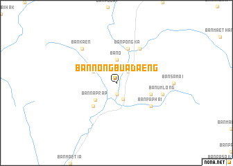
Ban Nong Bua Daeng (Lampang, Thailand)Ban Nong Bua Daeng is a town in the Lampang region of Thailand. An overview map of the region around Ban Nong Bua Daeng is displayed below.
regional and 3d topo map of Ban Nong Bua Daeng, Thailand ::
Ban Nong Bua Daeng airports ::
The nearest airport is LPT - Lampang, located 44.9 km north east of Ban Nong Bua Daeng.
Other airports nearby include PRH - Phrae (91.7 km east), PHS - Phitsanulok (159.3 km south east), Nearby towns ::
Ban Lai (1.9km south) //
Ban Wang Yao (2.6km north east) //
Sop Prap (2.8km south) //
Ban O (3.7km north) //
Ban Na Yang (4.0km north west) //
Ban Na Prap (4.3km south west) //
Ban Dong (5.1km south west) //
Ban Pong Ka (5.8km north) //
Ban Chua (5.6km east) //
Ban Pa Phai (6.5km south east) //
Ban Phae (6.6km north east) //
Ban Mae Kua (6.6km north east) //
Ban Um Long (7.3km east) //
Ban Kaen (7.7km north west) //
[all distances 'as the bird flies' and approximate]  Places with similar names to Ban Nong Bua Daeng, Thailand ::
// Ban Nong Bua Daeng (TH)
// Ban Nong Bua Daeng (TH)
// Ban Nong Bua Daeng (TH)
// Ban Nong Bua Daeng (TH)
// Ban Nong Bua Daeng (TH)
// Ban Nong Bua Daeng (TH)
// Ban Nong Bua Daeng (TH)
// Ban Nong Bua Tong (TH)
Disclaimer :: Information on this page comes without warranty of any kind |
||
|
Where is Ban Nong Bua Daeng? Elevation and coordinates ::
Latitude (lat): 17°54'0"N Longitude (lon): 99°20'0"E
Elevation (approx.): 194m (map arrows pan, magnifying glasses zoom) |
||
|
Visiting Ban Nong Bua Daeng? Hotel/Accommodation ::
Book a hotel in Ban Nong Bua Daeng Travel Guide ::
Buy a travel guide for Thailand rental cars ::
car rental offers GPS waypoint ::
download a GPX waypoint (PoI) of Ban Nong Bua Daeng for your GPS receiver
|
||