|
search place name
|
||
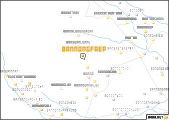
Ban Nong Faep (Nakhon Sawan, Thailand)Ban Nong Faep is a town in the Nakhon Sawan region of Thailand. An overview map of the region around Ban Nong Faep is displayed below.
regional and 3d topo map of Ban Nong Faep, Thailand ::
Ban Nong Faep airports ::
The nearest airport is PHS - Phitsanulok, located 112.9 km north east of Ban Nong Faep.
Other airports nearby include BKK - Bangkok Intl (234.1 km south), LOE - Loei (268.6 km north east), Nearby towns ::
Ban Suan Den (1.8km south east) //
Ban Suan Luang (3.4km north west) //
Ban Rai (4.0km south) //
Ban Don Muang (1) (5.2km south east) //
Ban Khlong Kradan (5.7km north) //
Ban Nong Mi (1) (6.1km south east) //
Ban Noen Khilek (6.6km south) //
Ban Nong Rai (8.2km south) //
Ban Bung Lom (8.1km south west) //
Ban Saen Saep Tai (8.0km east) //
Ban Nong Mai (8.1km east) //
Ban Thung Yai (1) (8.4km south) //
Ban Don Yao (10.8km south east) //
[all distances 'as the bird flies' and approximate] 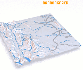 Places with similar names to Ban Nong Faep, Thailand ::
// Ban Nong Faep (TH)
// Ban Nong Faep (TH)
// Ban Nong Faep (TH)
// Ban Nong Faep (TH)
// Ban Nong Faep (TH)
// Ban Nong Faep (TH)
// Ban Nong Faep (TH)
// Ban Nong Faep (TH)
Disclaimer :: Information on this page comes without warranty of any kind |
||
|
Where is Ban Nong Faep? Elevation and coordinates ::
Latitude (lat): 15°52'32"N Longitude (lon): 99°47'45"E
Elevation (approx.): 45m (map arrows pan, magnifying glasses zoom) |
||
|
Visiting Ban Nong Faep? Hotel/Accommodation ::
Book a hotel in Ban Nong Faep Travel Guide ::
Buy a travel guide for Thailand rental cars ::
car rental offers GPS waypoint ::
download a GPX waypoint (PoI) of Ban Nong Faep for your GPS receiver
|
||