|
search place name
|
||
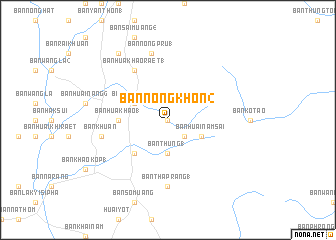
Ban Nong Khon (2) (Trang, Thailand)Ban Nong Khon (2) is a town in the Trang region of Thailand. An overview map of the region around Ban Nong Khon (2) is displayed below.
regional and 3d topo map of Ban Nong Khon (2), Thailand ::
Ban Nong Khon (2) airports ::
The nearest airport is TST - Trang, located 38.1 km south of Ban Nong Khon (2).
Other airports nearby include NST - Nakhon Si Thammarat Cha Ian (75.7 km north east), HDY - Songkhla Hat Yai Intl (129.3 km south east), HKT - Phuket Intl (151.6 km west), LGK - Pulau Langkawi Intl (168.3 km south), Nearby towns ::
Ban So Muang (1) (0.0km north) //
Ban Thung (2.6km south east) //
Ban Thung (1) (3.7km south) //
Ban Huai Nam Sai (4.1km south east) //
Ban Sai Muang (4.1km north west) //
Ban Nong Pru (4.1km north west) //
Ban Khao Khao (2) (5.2km south west) //
Ban Hua Khao (1) (5.5km west) //
Ban Hua Khao Raet (1) (6.7km north west) //
Ban Tha Prang (1) (7.4km south) //
Ban Nong Pru (1) (7.6km north) //
Ban Khuan (7.6km west) //
Ban Nong Khla (1) (9.2km north west) //
[all distances 'as the bird flies' and approximate] 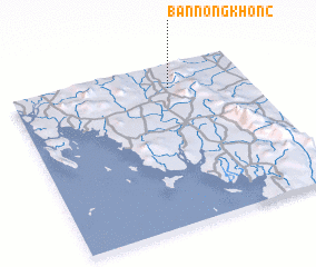 Places with similar names to Ban Nong Khon (2), Thailand ::
// Ban Nong Khai Nok (TH)
// Ban Nong Khanak (TH)
// Ban Nong Khanak (TH)
// Ban Nong Khang (TH)
// Ban Nong Khang (TH)
// Ban Nong Khang (TH)
// Ban Nong Khang (TH)
// Ban Nong Khao Ngai (TH)
// Ban Nong Khao Nok (TH)
// Ban Nong Kheng (TH)
Disclaimer :: Information on this page comes without warranty of any kind |
||
|
Where is Ban Nong Khon (2)? Elevation and coordinates ::
Latitude (lat): 7°51'0"N Longitude (lon): 99°40'0"E
Elevation (approx.): 73m (map arrows pan, magnifying glasses zoom) |
||
|
Visiting Ban Nong Khon (2)? Hotel/Accommodation ::
Book a hotel in Ban Nong Khon (2) Travel Guide ::
Buy a travel guide for Thailand rental cars ::
car rental offers GPS waypoint ::
download a GPX waypoint (PoI) of Ban Nong Khon (2) for your GPS receiver
|
||