|
search place name
|
||
Ban Nong Khu (Nakhon Ratchasima, Thailand)Ban Nong Khu is a town in the Nakhon Ratchasima region of Thailand. An overview map of the region around Ban Nong Khu is displayed below.
regional and 3d topo map of Ban Nong Khu, Thailand ::

Ban Nong Khu airports ::
The nearest airport is NAK - Nakhon Ratchasima Khorat, located 13.9 km east of Ban Nong Khu.
Other airports nearby include BKK - Bangkok Intl (184.8 km south west), REP - Siem-reap Siem Reap (263.5 km south east), PHS - Phitsanulok (270.5 km north west), Nearby towns ::
Ban Si Chan (0.0km north) //
Ban Nam Cha (1.6km south west) //
Ban Khok Faek (1.7km north east) //
Ban Khok Kruat (1.9km south) //
Ban Nong Khun (1.8km east) //
Ban Sa (2.7km south east) //
Ban Pong Daeng (3.2km west) //
Ban Dua (3.6km east) //
Ban Noi Non Takhop (3.9km north east) //
Ban Khlong Khwai (4.0km south east) //
Ban Non Hin (4.0km south west) //
Ban Nong Pet Nam (4.6km east) //
Kham Thale So (4.7km north east) //
Ban Bu Yai Yang (5.2km north east) //
Ban Salatdai (5.2km south west) //
Ban Huai Takhro (5.5km south west) //
Ban Kut Pla Khem (5.7km west) //
Ban Don (5.7km east) //
Ban Hua Sip (5.7km east) //
Ban Khong Yang (5.7km west) //
Ban Makham Thao (5.7km east) //
Ban Lalom Mo (6.3km west) //
Ban Nong Rang Ka (6.6km south east) //
Ban Mai (6.5km south west) //
Ban Kham (6.5km south west) //
Ban Don (6.6km north east) //
Ban Pong Hua Malaengwan (7.2km south) //
Ban Na Klang (7.5km south west) //
Ban Muang Li (7.4km west) //
[all distances 'as the bird flies' and approximate] 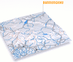 Places with similar names to Ban Nong Khu, Thailand ::
// Ban Ang Khai (TH)
// Ban Nong Kai Hoei (TH)
// Ban Nong Kha (TH)
// Ban Nong Kha (TH)
// Ban Nong Kha (TH)
// Ban Nong Kha (TH)
// Ban Nong Kha (TH)
// Ban Nong Kha (TH)
// Ban Nong Kha (TH)
// Ban Nong Kha (TH)
Disclaimer :: Information on this page comes without warranty of any kind |
||
|
Where is Ban Nong Khu? Elevation and coordinates ::
Latitude (lat): 14°57'0"N Longitude (lon): 101°57'0"E
Elevation (approx.): 202m (map arrows pan, magnifying glasses zoom) |
||
|
Visiting Ban Nong Khu? Hotel/Accommodation ::
Book a hotel in Ban Nong Khu Travel Guide ::
Buy a travel guide for Thailand rental cars ::
car rental offers GPS waypoint ::
download a GPX waypoint (PoI) of Ban Nong Khu for your GPS receiver
|
||