|
search place name
|
||
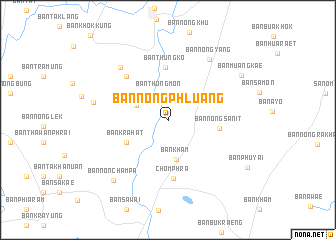
Ban Nong Phluang (Surin, Thailand)Ban Nong Phluang is a town in the Surin region of Thailand. An overview map of the region around Ban Nong Phluang is displayed below.
regional and 3d topo map of Ban Nong Phluang, Thailand ::
Ban Nong Phluang airports ::
The nearest airport is NAK - Nakhon Ratchasima Khorat, located 166.6 km west of Ban Nong Phluang.
Other airports nearby include REP - Siem-reap Siem Reap (196.2 km south), ZVK - Savannakhet (196.6 km north east), Nearby towns ::
Ban Thung Mon (3.1km north) //
Ban Non Sung (3.8km north west) //
Ban Kham (4.5km south) //
Ban Krahat (5.2km south west) //
Ban Nong Sanit (5.6km east) //
Ban Thung Ko (5.9km north) //
Chom Phra (6.5km south) //
Ban Ba (6.6km north west) //
Ban Nong Phai (7.8km north west) //
Ban Nong Yang (8.0km north east) //
Ban Sombun (8.3km west) //
Ban Non Champa (8.9km south west) //
Ban Muang Kae (9.3km north east) //
Ban Phu Yai (10.0km south east) //
[all distances 'as the bird flies' and approximate] 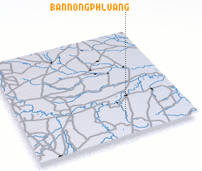 Places with similar names to Ban Nong Phluang, Thailand ::
// Ban Nong Phai Lang (TH)
// Ban Nong Phlong (TH)
// Ban Nong Phlong (TH)
// Ban Nong Phluang (TH)
// Ban Nong Phluang (TH)
// Ban Nong Phluang (TH)
// Ban Nong Phluang (TH)
// Ban Nong Phluang (TH)
// Ban Nong Phluang (TH)
// Ban Nong Phluang (TH)
Disclaimer :: Information on this page comes without warranty of any kind |
||
|
Where is Ban Nong Phluang? Elevation and coordinates ::
Latitude (lat): 15°10'23"N Longitude (lon): 103°36'31"E
Elevation (approx.): 143m (map arrows pan, magnifying glasses zoom) |
||
|
Visiting Ban Nong Phluang? Hotel/Accommodation ::
Book a hotel in Ban Nong Phluang Travel Guide ::
Buy a travel guide for Thailand rental cars ::
car rental offers GPS waypoint ::
download a GPX waypoint (PoI) of Ban Nong Phluang for your GPS receiver
|
||