|
search place name
|
||
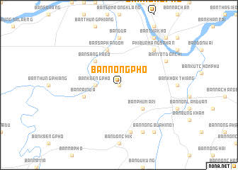
Ban Nong Pho (Thailand)Ban Nong Pho is a town in Thailand. An overview map of the region around Ban Nong Pho is displayed below.
regional and 3d topo map of Ban Nong Pho, Thailand ::
Ban Nong Pho airports ::
The nearest airport is PKZ - Pakse, located 64.5 km east of Ban Nong Pho.
Other airports nearby include ZVK - Savannakhet (158.6 km north), REP - Siem-reap Siem Reap (245.6 km south west), Nearby towns ::
Amphoe Phibun Mangsahan (0.0km north) //
Ban Non Muang (0.0km north) //
Ban Pho Si (0.0km north) //
Ban Kaeng Pho (3.6km west) //
Ban Sang Kaeo (5.2km north west) //
Ban Phu Mari (5.2km south east) //
Ban Rai Nua (5.7km west) //
Ban Saphan Dom (5.8km north) //
Ban Dua (7.4km north) //
Ban Na Ngam Chat Hi (7.6km south) //
Phibun Mangsahan (7.7km north east) //
Ban Muang Maet (8.2km south east) //
Ban Yot Don Chi (8.1km north east) //
Ban Nong Bua Hi Noi (9.2km south east) //
Ban Tha Kho (9.2km north east) //
Ban Saphu (10.3km north east) //
[all distances 'as the bird flies' and approximate] 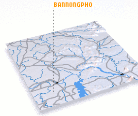 Places with similar names to Ban Nong Pho, Thailand ::
// Ban Ang Phai (TH)
// Ban Nong Fa (TH)
// Ban Nong Pha (TH)
// Ban Nong Pha (TH)
// Ban Nong Phai (TH)
// Ban Nong Phai (TH)
// Ban Nong Phai (TH)
// Ban Nong Phai (TH)
// Ban Nong Phai (TH)
// Ban Nong Phai (TH)
Disclaimer :: Information on this page comes without warranty of any kind |
||
|
Where is Ban Nong Pho? Elevation and coordinates ::
Latitude (lat): 15°11'0"N Longitude (lon): 105°11'0"E
Elevation (approx.): 136m (map arrows pan, magnifying glasses zoom) |
||
|
Visiting Ban Nong Pho? Hotel/Accommodation ::
Book a hotel in Ban Nong Pho Travel Guide ::
Buy a travel guide for Thailand rental cars ::
car rental offers GPS waypoint ::
download a GPX waypoint (PoI) of Ban Nong Pho for your GPS receiver
|
||