|
search place name
|
||
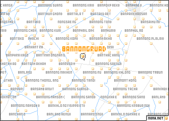
Ban Nong Rua (3) (Sara Buri, Thailand)Ban Nong Rua (3) is a town in the Sara Buri region of Thailand. An overview map of the region around Ban Nong Rua (3) is displayed below.
regional and 3d topo map of Ban Nong Rua (3), Thailand ::
Ban Nong Rua (3) airports ::
The nearest airport is BKK - Bangkok Intl, located 60.2 km south of Ban Nong Rua (3).
Other airports nearby include NAK - Nakhon Ratchasima Khorat (147.5 km north east), UTP - Rayong U Taphao Intl (193.2 km south), HHQ - Prachuap Khiri Khan Hua Hin (218.1 km south west), Nearby towns ::
Ban Nong Lao (2) (1.9km north) //
Ban Nong Lom (1.9km north) //
Ban Tao Lamun (1.8km east) //
Ban Nong Madan (1.8km east) //
Ban Nong No (1.8km west) //
Ban Nong Phai (2) (1.8km west) //
Ban Nong Saeng (1) (2.6km north east) //
Ban Khlang (2.6km north east) //
Ban Dong Wai (2.6km north east) //
Ban Nong Chok (1) (2.6km north west) //
Ban Nong Um (2.6km south east) //
Ban Khok Khi Lek (2.6km south east) //
Ban Khon Changok (2.6km south west) //
Ban Nong Ta Lo (1) (2.6km south west) //
Ban Khok Khae (3.7km south) //
Ban Nong Phlap (1) (3.6km west) //
Ban Khok Daeng (3.6km west) //
Ban Nong Chang Lek (1) (4.0km north east) //
Ban Nong Chik (1) (4.0km north east) //
Ban Bok Noi (4.0km north east) //
Ban Muang Wan (1) (4.1km north east) //
Ban Nong Kwang Chon (1) (4.1km north east) //
Ban Bua Loi (1) (4.0km south east) //
Ban Non Khwao (1) (4.1km north west) //
Ban Huai Ba (1) (4.0km north west) //
Ban Nong Ru (4.1km south east) //
Ban Rasom (4.0km south west) //
Ban Khok Krachan (1) (4.0km south west) //
Ban San Makha (5.2km north east) //
[all distances 'as the bird flies' and approximate]  Places with similar names to Ban Nong Rua (3), Thailand ::
Disclaimer :: Information on this page comes without warranty of any kind |
||
|
Where is Ban Nong Rua (3)? Elevation and coordinates ::
Latitude (lat): 14°25'0"N Longitude (lon): 100°49'0"E
Elevation (approx.): 10m (map arrows pan, magnifying glasses zoom) |
||
|
Visiting Ban Nong Rua (3)? Hotel/Accommodation ::
Book a hotel in Ban Nong Rua (3) Travel Guide ::
Buy a travel guide for Thailand rental cars ::
car rental offers GPS waypoint ::
download a GPX waypoint (PoI) of Ban Nong Rua (3) for your GPS receiver
|
||