|
search place name
|
||
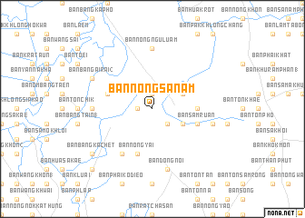
Ban Nong Sanam (Prachin Buri, Thailand)Ban Nong Sanam is a town in the Prachin Buri region of Thailand. An overview map of the region around Ban Nong Sanam is displayed below.
regional and 3d topo map of Ban Nong Sanam, Thailand ::
Ban Nong Sanam airports ::
The nearest airport is BKK - Bangkok Intl, located 73.2 km west of Ban Nong Sanam.
Other airports nearby include UTP - Rayong U Taphao Intl (136.5 km south), NAK - Nakhon Ratchasima Khorat (144.5 km north east), HHQ - Prachuap Khiri Khan Hua Hin (199.7 km south west), Nearby towns ::
Ban Bang Kham (1) (1.8km west) //
Ban Nong Chang Lai (1.9km north) //
Ban Sakae Tung (2.6km south east) //
Ban Sakae Ngam (4.0km south east) //
Ban Bang Pla Ra (4.0km north east) //
Ban Krathum Phaeo (5.4km east) //
Ban Nong Yai (5.8km south) //
Ban Sam Ruan (5.7km east) //
Ban Klang Thung (5.7km west) //
Ban Nam Cha (6.6km south west) //
Ban Lam Ai Chot (7.2km west) //
Ban Nong Ngu Luam (7.4km north) //
Ban Dong Noi (7.6km south) //
Ban Don Ta Hom (7.4km east) //
Ban Bang Ai Rai (2) (8.1km north west) //
Ban Bang Kachet (9.1km south west) //
Ban Don Nong Ri (10.3km south west) //
[all distances 'as the bird flies' and approximate] 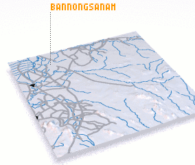 Places with similar names to Ban Nong Sanam, Thailand ::
// Ban Nong Sanom (TH)
// Ban Nong Sanom (TH)
// Ban Nong Sanom (TH)
// Ban Nong Sanom (TH)
// Ban Nong Sanom (TH)
// Ban Nong Sanom (TH)
// Ban Nong Sanom (TH)
Disclaimer :: Information on this page comes without warranty of any kind |
||
|
Where is Ban Nong Sanam? Elevation and coordinates ::
Latitude (lat): 13°53'0"N Longitude (lon): 101°17'0"E
Elevation (approx.): 2m (map arrows pan, magnifying glasses zoom) |
||
|
Visiting Ban Nong Sanam? Hotel/Accommodation ::
Book a hotel in Ban Nong Sanam Travel Guide ::
Buy a travel guide for Thailand rental cars ::
car rental offers GPS waypoint ::
download a GPX waypoint (PoI) of Ban Nong Sanam for your GPS receiver
|
||