|
search place name
|
||
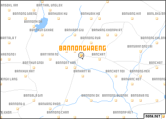
Ban Nong Waeng (Khon Kaen, Thailand)Ban Nong Waeng is a town in the Khon Kaen region of Thailand. An overview map of the region around Ban Nong Waeng is displayed below.
regional and 3d topo map of Ban Nong Waeng, Thailand ::
Ban Nong Waeng airports ::
The nearest airport is NAK - Nakhon Ratchasima Khorat, located 111.8 km south west of Ban Nong Waeng.
Other airports nearby include UTH - Udon Thani (176.5 km north), LOE - Loei (205.0 km north west), SNO - Sakon Nakhon (222.6 km north east), Nearby towns ::
Phon (2.6km north west) //
Ban Non Kha (2.6km south west) //
Ban Han Yai (3.7km south) //
Ban Chat (3.6km east) //
Ban Nong Rua (4.1km north east) //
Ban Non Than (4.0km south west) //
Ban Chat Noi (4.0km south west) //
Ban Sa Bua (4.0km north west) //
Ban Kao Ngiu (5.8km north) //
Ban Ya Nang (7.1km west) //
Ban Nong Pha (7.1km west) //
Ban Wang Khon Phat (7.7km north east) //
Ban Chot Noi (8.0km south east) //
Ban Sok Nok Ten (9.0km north east) //
[all distances 'as the bird flies' and approximate] 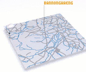 Places with similar names to Ban Nong Waeng, Thailand ::
// Ban Nong Waeng (TH)
// Ban Nong Waeng (TH)
// Ban Nong Waeng (TH)
// Ban Nong Waeng (TH)
// Ban Nong Waeng (TH)
// Ban Nong Waeng (TH)
// Ban Nong Waeng (TH)
// Ban Nong Waeng (TH)
// Ban Nong Waeng (TH)
// Ban Nong Waeng (TH)
Disclaimer :: Information on this page comes without warranty of any kind |
||
|
Where is Ban Nong Waeng? Elevation and coordinates ::
Latitude (lat): 15°48'0"N Longitude (lon): 102°37'0"E
Elevation (approx.): 171m (map arrows pan, magnifying glasses zoom) |
||
|
Visiting Ban Nong Waeng? Hotel/Accommodation ::
Book a hotel in Ban Nong Waeng Travel Guide ::
Buy a travel guide for Thailand rental cars ::
car rental offers GPS waypoint ::
download a GPX waypoint (PoI) of Ban Nong Waeng for your GPS receiver
|
||