|
search place name
|
||
Ban Non U-dom (Udon Thani, Thailand)Ban Non U-dom is a town in the Udon Thani region of Thailand. An overview map of the region around Ban Non U-dom is displayed below.
regional and 3d topo map of Ban Non U-dom, Thailand ::

Ban Non U-dom airports ::
The nearest airport is UTH - Udon Thani, located 46.7 km east of Ban Non U-dom.
Other airports nearby include LOE - Loei (69.6 km west), VTE - Vientiane Wattay Intl (79.7 km north), SNO - Sakon Nakhon (187.4 km east), Nearby towns ::
Ban Non Sombun (4.3km south west) //
Ban Don Ya Nang (4.5km south east) //
Ban Pho Si Sa-at (4.9km north east) //
Ban Yang Luang (5.4km north west) //
Ban Na Kham Hai (5.9km west) //
Ban Thung Prong (7.7km north) //
Ban Nong No (7.8km north east) //
Ban Kut Chim (8.9km south) //
Ban Don Noi (9.3km south east) //
Ban Nong Tae (9.4km north west) //
Ban Hin Lap (10.7km south west) //
[all distances 'as the bird flies' and approximate] 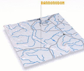 Places with similar names to Ban Non U-dom, Thailand ::
// Ban Non Tum (TH)
// Ban Non Tum (TH)
// Ban Non Tum (TH)
// Ban Non Tum (TH)
// Ban Non Tum (TH)
// Banantombo (GN)
// Banan Toumbo (GN)
// Banan Toumbo (GN)
// Ban Nôntoum (LA)
// Banandomo (ML)
Disclaimer :: Information on this page comes without warranty of any kind |
||
|
Where is Ban Non U-dom? Elevation and coordinates ::
Latitude (lat): 17°17'43"N Longitude (lon): 102°21'35"E
Elevation (approx.): 256m (map arrows pan, magnifying glasses zoom) |
||
|
Visiting Ban Non U-dom? Hotel/Accommodation ::
Book a hotel in Ban Non U-dom Travel Guide ::
Buy a travel guide for Thailand rental cars ::
car rental offers GPS waypoint ::
download a GPX waypoint (PoI) of Ban Non U-dom for your GPS receiver
|
||