|
search place name
|
||
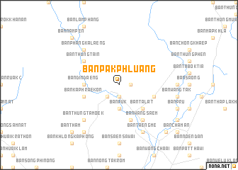
Ban Pak Phluang (Chanthaburi, Thailand)Ban Pak Phluang is a town in the Chanthaburi region of Thailand. An overview map of the region around Ban Pak Phluang is displayed below.
regional and 3d topo map of Ban Pak Phluang, Thailand ::
Ban Pak Phluang airports ::
The nearest airport is UTP - Rayong U Taphao Intl, located 123.2 km west of Ban Pak Phluang.
Other airports nearby include REP - Siem-reap Siem Reap (194.2 km east), BKK - Bangkok Intl (206.1 km north west), Nearby towns ::
Ban Thung Saphan (1.9km south) //
Ban Phluang (1.8km east) //
Ban Krathing (2.6km south west) //
Ban Khani (2.6km south west) //
Ban Puk (3.7km south) //
Ban Khok Thong (5.2km south east) //
Ban Talat (5.2km south east) //
Ban Din Daeng (5.4km west) //
Ban Kraeng (5.7km east) //
Ban Kaphraek On (5.7km west) //
Ban Khanun (5.8km south) //
Ban Thung Ta In (6.6km north west) //
Ban Wang Saem (6.6km south east) //
Ban Phang Kalaeng (7.8km north west) //
Ban Thung Ta Moek (7.8km south west) //
Ban Taengme (8.2km south east) //
Ban Chak Wet (9.2km south west) //
Ban Nam Pen (10.4km north west) //
Ban Tham (10.4km south west) //
Ban Phayat Bon (10.4km south east) //
[all distances 'as the bird flies' and approximate] 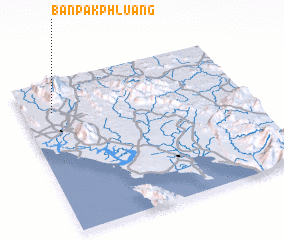 Places with similar names to Ban Pak Phluang, Thailand :: Disclaimer :: Information on this page comes without warranty of any kind |
||
|
Where is Ban Pak Phluang? Elevation and coordinates ::
Latitude (lat): 12°48'0"N Longitude (lon): 102°8'0"E
Elevation (approx.): 33m (map arrows pan, magnifying glasses zoom) |
||
|
Visiting Ban Pak Phluang? Hotel/Accommodation ::
Book a hotel in Ban Pak Phluang Travel Guide ::
Buy a travel guide for Thailand rental cars ::
car rental offers GPS waypoint ::
download a GPX waypoint (PoI) of Ban Pak Phluang for your GPS receiver
|
||