|
search place name
|
||
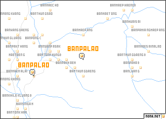
Ban Pa Lao (Chiang Mai, Thailand)Ban Pa Lao is a town in the Chiang Mai region of Thailand. An overview map of the region around Ban Pa Lao is displayed below.
regional and 3d topo map of Ban Pa Lao, Thailand ::
Ban Pa Lao airports ::
The nearest airport is LPT - Lampang, located 103.6 km south east of Ban Pa Lao.
Other airports nearby include MOG - Mong Hsat (156.1 km north), PRH - Phrae (157.8 km south east), THL - Tachilek Tachileik (175.7 km north east), Nearby towns ::
Ban San Na Meng (2.5km south west) //
Ban Muang Wa (3.5km west) //
Ban Thung Daeng (3.7km south) //
Ban Pa Khaem (4.0km south west) //
Ban Huai Sai (5.6km north) //
Ban Huai Ngu (5.6km north) //
Ban Mae Pang (5.6km north) //
Ban Hua Fai (5.3km west) //
Ban Kat (5.6km west) //
Ban Pa Phai (5.6km west) //
Ban Ton Phung (1) (7.0km west) //
Ban Mae Ho Phra (7.0km west) //
Ban San Pa Sak (7.2km west) //
Ban Cho Lae (7.9km north west) //
[all distances 'as the bird flies' and approximate]  Places with similar names to Ban Pa Lao, Thailand ::
// Ban Na Pla (TH)
// Ban Na Plai (TH)
// Ban Pala (TH)
// Ban Pa Laeo (TH)
// Ban Pa Lao (TH)
// Ban Pa Lao (TH)
// Ban Pa Lao (TH)
// Ban Pa Lao (TH)
// Ban Pa Lao (TH)
// Ban Pa Lao (TH)
Disclaimer :: Information on this page comes without warranty of any kind |
||
|
Where is Ban Pa Lao? Elevation and coordinates ::
Latitude (lat): 19°7'0"N Longitude (lon): 99°5'0"E
Elevation (approx.): 562m (map arrows pan, magnifying glasses zoom) |
||
|
Visiting Ban Pa Lao? Hotel/Accommodation ::
Book a hotel in Ban Pa Lao Travel Guide ::
Buy a travel guide for Thailand rental cars ::
car rental offers GPS waypoint ::
download a GPX waypoint (PoI) of Ban Pa Lao for your GPS receiver
|
||