|
search place name
|
||
Ban Pang Hin Fon (Chiang Mai, Thailand)Ban Pang Hin Fon is a town in the Chiang Mai region of Thailand. An overview map of the region around Ban Pang Hin Fon is displayed below.
regional and 3d topo map of Ban Pang Hin Fon, Thailand ::

Ban Pang Hin Fon airports ::
The nearest airport is LPT - Lampang, located 137.2 km east of Ban Pang Hin Fon.
Other airports nearby include PRH - Phrae (208.7 km east), Nearby towns ::
Ban Yang Pang Tong (2.2km south west) //
Ban Mae Tum Tai (4.1km north west) //
Ban Mae Ho (4.8km south west) //
Ban Phui Klang (5.2km north east) //
Ban Yang Hae (5.2km south west) //
Ban Thuan (6.2km north east) //
Ban Khong (6.5km west) //
Ban Pae (6.9km west) //
Ban Mae Khi Muk (7.8km east) //
Ban Kok Noi (8.3km west) //
Ban Mut Long (8.6km south west) //
Ban Thung Kae (9.0km south) //
Ban Phakha (9.7km north east) //
Ban Sa Lo Sa (11.9km south west) //
[all distances 'as the bird flies' and approximate] 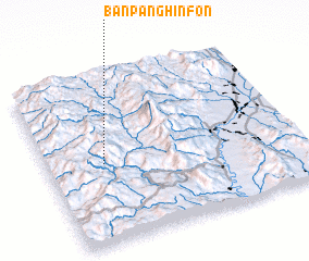 Places with similar names to Ban Pang Hin Fon, Thailand :: Disclaimer :: Information on this page comes without warranty of any kind |
||
|
Where is Ban Pang Hin Fon? Elevation and coordinates ::
Latitude (lat): 18°28'45"N Longitude (lon): 98°13'28"E
Elevation (approx.): 1298m (map arrows pan, magnifying glasses zoom) |
||
|
Visiting Ban Pang Hin Fon? Hotel/Accommodation ::
Book a hotel in Ban Pang Hin Fon Travel Guide ::
Buy a travel guide for Thailand rental cars ::
car rental offers GPS waypoint ::
download a GPX waypoint (PoI) of Ban Pang Hin Fon for your GPS receiver
|
||