|
search place name
|
||
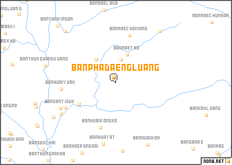
Ban Pha Daeng Luang (Mae Hong Son, Thailand)Ban Pha Daeng Luang is a town in the Mae Hong Son region of Thailand. An overview map of the region around Ban Pha Daeng Luang is displayed below.
regional and 3d topo map of Ban Pha Daeng Luang, Thailand ::
Ban Pha Daeng Luang airports ::
The nearest airport is LPT - Lampang, located 161.1 km east of Ban Pha Daeng Luang.
Other airports nearby include MOG - Mong Hsat (251.4 km north east), RGN - Yangon Intl (271.7 km south west), THL - Tachilek Tachileik (292.1 km north east), Nearby towns ::
Ban Mae Om Phai Tai (3.8km north) //
Ban Huai Maisang (4.8km north west) //
Ban Mae Tho (4.9km north) //
Ban Hua La (6.7km south west) //
Ban Huai Kong Ko (7.7km south) //
Ban Mae Cho Kiang (8.0km north) //
Ban Huai Yuak (8.4km west) //
Ban Thung Pa Kha (8.8km south west) //
Ban Mae La Luang (9.9km south west) //
Ban Khun Mae-Tho (10.7km north east) //
Ban Nong Haeng (11.3km north west) //
[all distances 'as the bird flies' and approximate] 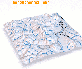 Places with similar names to Ban Pha Daeng Luang, Thailand ::
// Ban Phi Tong Luang (TH)
// Ban Phoutoungloung (LA)
Disclaimer :: Information on this page comes without warranty of any kind |
||
|
Where is Ban Pha Daeng Luang? Elevation and coordinates ::
Latitude (lat): 18°34'33"N Longitude (lon): 98°0'46"E
Elevation (approx.): 783m (map arrows pan, magnifying glasses zoom) |
||
|
Visiting Ban Pha Daeng Luang? Hotel/Accommodation ::
Book a hotel in Ban Pha Daeng Luang Travel Guide ::
Buy a travel guide for Thailand rental cars ::
car rental offers GPS waypoint ::
download a GPX waypoint (PoI) of Ban Pha Daeng Luang for your GPS receiver
|
||