|
search place name
|
||
Ban Phak Waen (Ubon Ratchathani, Thailand)Ban Phak Waen is a town in the Ubon Ratchathani region of Thailand. An overview map of the region around Ban Phak Waen is displayed below.
regional and 3d topo map of Ban Phak Waen, Thailand ::

Ban Phak Waen airports ::
The nearest airport is ZVK - Savannakhet, located 126.0 km north of Ban Phak Waen.
Other airports nearby include PKZ - Pakse (143.8 km east), SNO - Sakon Nakhon (197.0 km north), UTH - Udon Thani (280.5 km north west), Nearby towns ::
Ban Kok (5.8km north) //
Ban Yang Khi Nok (5.7km east) //
Ban Kheng (6.5km north east) //
Ban Non Rang (7.4km north east) //
Ban Phon Thong (7.4km west) //
Ban Si Suk (7.4km east) //
Ban Thung Yai (7.4km west) //
Ban Klang Yai (9.1km north west) //
Ban Kaeng Pho (9.5km south west) //
Khuang Nai (10.3km south east) //
[all distances 'as the bird flies' and approximate] 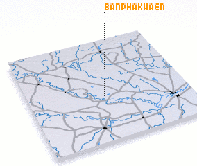 Places with similar names to Ban Phak Waen, Thailand ::
// Ban Phak Wan (TH)
// Ban Phak Wan Noi (TH)
Disclaimer :: Information on this page comes without warranty of any kind |
||
|
Where is Ban Phak Waen? Elevation and coordinates ::
Latitude (lat): 15°27'0"N Longitude (lon): 104°29'0"E
Elevation (approx.): 131m (map arrows pan, magnifying glasses zoom) |
||
|
Visiting Ban Phak Waen? Hotel/Accommodation ::
Book a hotel in Ban Phak Waen Travel Guide ::
Buy a travel guide for Thailand rental cars ::
car rental offers GPS waypoint ::
download a GPX waypoint (PoI) of Ban Phak Waen for your GPS receiver
|
||