|
search place name
|
||
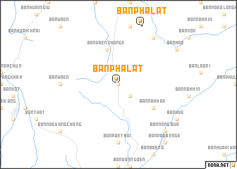
Ban Pha Lat (Thailand)Ban Pha Lat is a town in Thailand. An overview map of the region around Ban Pha Lat is displayed below.
regional and 3d topo map of Ban Pha Lat, Thailand ::
Ban Pha Lat airports ::
The nearest airport is THL - Tachilek Tachileik, located 131.7 km north of Ban Pha Lat.
Other airports nearby include PRH - Phrae (135.8 km south), LPT - Lampang (147.0 km south west), MOG - Mong Hsat (170.3 km north west), LPQ - Luang Prabang Luang Phabang Intl (202.7 km east), Nearby towns ::
Ban Wang Tha (0.0km north) //
Ban Pang Phak Hom (2.5km south east) //
Ban Waen Khong (1) (5.8km north) //
Ban Nam Hak (6.4km south east) //
Ban Tham (9.1km north east) //
Ban Nong Bua (10.2km south east) //
[all distances 'as the bird flies' and approximate]  Places with similar names to Ban Pha Lat, Thailand ::
// Benefeld (DE)
// Bonfeld (DE)
// Büenfeld (DE)
// Bonfield (US)
// Ban Na Phlat (TH)
// Ban Phai Lot (TH)
// Ban Pha Lat (TH)
// Ban Pha Lat (TH)
// Ban Pha Lat (TH)
// Ban Pha Lat (TH)
Disclaimer :: Information on this page comes without warranty of any kind |
||
|
Where is Ban Pha Lat? Elevation and coordinates ::
Latitude (lat): 19°21'0"N Longitude (lon): 100°19'0"E
Elevation (approx.): 417m (map arrows pan, magnifying glasses zoom) |
||
|
Visiting Ban Pha Lat? Hotel/Accommodation ::
Book a hotel in Ban Pha Lat Travel Guide ::
Buy a travel guide for Thailand rental cars ::
car rental offers GPS waypoint ::
download a GPX waypoint (PoI) of Ban Pha Lat for your GPS receiver
|
||