|
search place name
|
||
Ban Pho Huai (Surin, Thailand)Ban Pho Huai is a town in the Surin region of Thailand. An overview map of the region around Ban Pho Huai is displayed below.
regional and 3d topo map of Ban Pho Huai, Thailand ::

Ban Pho Huai airports ::
The nearest airport is NAK - Nakhon Ratchasima Khorat, located 129.3 km south west of Ban Pho Huai.
Other airports nearby include ZVK - Savannakhet (211.0 km north east), UTH - Udon Thani (219.9 km north), SNO - Sakon Nakhon (219.9 km north east), Nearby towns ::
Ban Khaen Bon (2.6km north west) //
Ban Chat (4.1km south east) //
Ban Muang Laeng (5.8km north) //
Ban Sa Khut (5.7km west) //
Ban Muang Sua (7.4km east) //
Ban Muang (10.3km south west) //
Ban Khi Lek (10.3km north east) //
[all distances 'as the bird flies' and approximate] 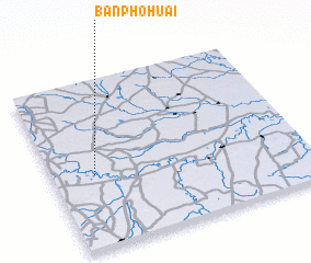 Places with similar names to Ban Pho Huai, Thailand ::
// Ban Foei Hai (TH)
// Ban Pha Hao (TH)
// Ban Pha Hu (TH)
// Ban Phu Hi (TH)
// Ban Phu Hi (TH)
// Ban Avahô (LA)
// Ban Pha Hoa (LA)
// Ban Phahoy (LA)
// Ban Phiaha (LA)
// Ban Pho Hièou (LA)
Disclaimer :: Information on this page comes without warranty of any kind |
||
|
Where is Ban Pho Huai? Elevation and coordinates ::
Latitude (lat): 15°26'0"N Longitude (lon): 103°10'0"E
Elevation (approx.): 135m (map arrows pan, magnifying glasses zoom) |
||
|
Visiting Ban Pho Huai? Hotel/Accommodation ::
Book a hotel in Ban Pho Huai Travel Guide ::
Buy a travel guide for Thailand rental cars ::
car rental offers GPS waypoint ::
download a GPX waypoint (PoI) of Ban Pho Huai for your GPS receiver
|
||