|
search place name
|
||
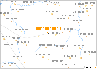
Ban Phon Ngam (Udon Thani, Thailand)Ban Phon Ngam is a town in the Udon Thani region of Thailand. An overview map of the region around Ban Phon Ngam is displayed below.
regional and 3d topo map of Ban Phon Ngam, Thailand ::
Ban Phon Ngam airports ::
The nearest airport is UTH - Udon Thani, located 20.5 km west of Ban Phon Ngam.
Other airports nearby include VTE - Vientiane Wattay Intl (82.1 km north west), SNO - Sakon Nakhon (122.5 km east), LOE - Loei (133.9 km west), ZVK - Savannakhet (209.5 km south east), Nearby towns ::
Ban Na Ngiu (2.3km north) //
Ban Kang (2.8km east) //
Ban Nikhom Nong Tan (3.5km west) //
Ban Nong Song Hong (5.1km south) //
Ban Pa Kao (5.0km east) //
Ban Kang (7.0km north east) //
Ban Phak Top (7.3km south east) //
Ban Muang (7.6km east) //
Ban Nong Tao (8.1km north) //
Ban Chiang Klom (9.0km south) //
Ban Nong Wa (9.0km south west) //
Ban Soi Phrao (9.7km north east) //
[all distances 'as the bird flies' and approximate]  Places with similar names to Ban Phon Ngam, Thailand ::
// Ban Na Phiang Mai (TH)
// Ban Phai Ngam (TH)
// Ban Pho Ngam (TH)
// Ban Pho Ngam (TH)
// Ban Pho Ngam (TH)
// Ban Pho Ngam (TH)
// Ban Phon Ngam (TH)
// Ban Phon Ngam (TH)
// Ban Phon Ngam (TH)
// Ban Phon Ngam (TH)
Disclaimer :: Information on this page comes without warranty of any kind |
||
|
Where is Ban Phon Ngam? Elevation and coordinates ::
Latitude (lat): 17°21'49"N Longitude (lon): 102°58'47"E
Elevation (approx.): 181m (map arrows pan, magnifying glasses zoom) |
||
|
Visiting Ban Phon Ngam? Hotel/Accommodation ::
Book a hotel in Ban Phon Ngam Travel Guide ::
Buy a travel guide for Thailand rental cars ::
car rental offers GPS waypoint ::
download a GPX waypoint (PoI) of Ban Phon Ngam for your GPS receiver
|
||