|
search place name
|
||
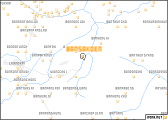
Ban Sakoen (Chiang Rai, Thailand)Ban Sakoen is a town in the Chiang Rai region of Thailand. An overview map of the region around Ban Sakoen is displayed below.
regional and 3d topo map of Ban Sakoen, Thailand ::
Ban Sakoen airports ::
The nearest airport is THL - Tachilek Tachileik, located 62.9 km north of Ban Sakoen.
Other airports nearby include MOG - Mong Hsat (99.6 km north west), KET - Kengtung (157.2 km north), LPT - Lampang (188.6 km south), PRH - Phrae (198.6 km south), Nearby towns ::
Ban Tha Ban Dai (2.5km north west) //
Ban Thung Ko (4.1km south west) //
Ban Muang Chum (4.1km south west) //
Ban Hong Hi (5.1km north east) //
Wiang Chai (6.4km south west) //
Ban Pa Yang (7.0km west) //
Ban Mong Kong (7.6km north) //
Ban Rong Wai (7.6km north) //
Ban Fam (7.2km west) //
Ban Bong Luang (7.6km south) //
Ban Dai (7.9km south west) //
Ban Thung Ko (10.2km north east) //
Ban Pang Poi (10.2km south west) //
[all distances 'as the bird flies' and approximate] 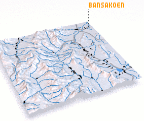 Places with similar names to Ban Sakoen, Thailand ::
// Ban Sak Noi (TH)
// Ban Sakoen (TH)
// Ban Sok Noi (TH)
// Ban Sukon (TH)
// Banī Seggane (TN)
// Bānsgaon (IN)
// Ban Sagnè (LA)
// Ban Sakan (LA)
// Ban Sakan (LA)
// Ban Sakèn (LA)
Disclaimer :: Information on this page comes without warranty of any kind |
||
|
Where is Ban Sakoen? Elevation and coordinates ::
Latitude (lat): 19°55'0"N Longitude (lon): 99°58'0"E
Elevation (approx.): 382m (map arrows pan, magnifying glasses zoom) |
||
|
Visiting Ban Sakoen? Hotel/Accommodation ::
Book a hotel in Ban Sakoen Travel Guide ::
Buy a travel guide for Thailand rental cars ::
car rental offers GPS waypoint ::
download a GPX waypoint (PoI) of Ban Sakoen for your GPS receiver
|
||