|
search place name
|
||
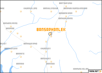
Ban Saphan Lek (Thailand)Ban Saphan Lek is a town in Thailand. An overview map of the region around Ban Saphan Lek is displayed below.
regional and 3d topo map of Ban Saphan Lek, Thailand ::
Ban Saphan Lek airports ::
The nearest airport is HDY - Songkhla Hat Yai Intl, located 38.0 km north east of Ban Saphan Lek.
Other airports nearby include LGK - Pulau Langkawi Intl (63.7 km south west), AOR - Alor Setar Sultan Abdul Halim (74.3 km south east), TST - Trang (95.4 km north west), PAN - Pattani (118.3 km east), Nearby towns ::
Ban Ket Ya Mu (0.0km north) //
Ban Thung Tam Lao (0.0km north) //
Ban Du Son (1.9km north) //
Ban Pan Cho (2.6km south west) //
Khuan Don (5.9km south) //
Ban Chin (5.9km south) //
Ban Hua Ka Ming (7.8km north east) //
Ban Khuan Pho (8.2km south west) //
Ban Ba Nam Ron (9.2km north east) //
[all distances 'as the bird flies' and approximate] 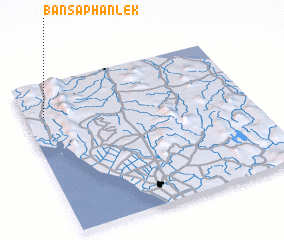 Places with similar names to Ban Saphan Lek, Thailand :: Disclaimer :: Information on this page comes without warranty of any kind |
||
|
Where is Ban Saphan Lek? Elevation and coordinates ::
Latitude (lat): 6°47'0"N Longitude (lon): 100°5'0"E
Elevation (approx.): 35m (map arrows pan, magnifying glasses zoom) |
||
|
Visiting Ban Saphan Lek? Hotel/Accommodation ::
Book a hotel in Ban Saphan Lek Travel Guide ::
Buy a travel guide for Thailand rental cars ::
car rental offers GPS waypoint ::
download a GPX waypoint (PoI) of Ban Saphan Lek for your GPS receiver
|
||