|
search place name
|
||
Ban Song Khirl (Narathiwat, Thailand)Ban Song Khirl is a town in the Narathiwat region of Thailand. An overview map of the region around Ban Song Khirl is displayed below.
regional and 3d topo map of Ban Song Khirl, Thailand ::

Ban Song Khirl airports ::
The nearest airport is NAW - Narathiwat, located 56.9 km north of Ban Song Khirl.
Other airports nearby include KBR - Kota Bahru Sultan Ismail Petra (59.5 km east), PAN - Pattani (110.5 km north west), AOR - Alor Setar Sultan Abdul Halim (154.3 km west), TGG - Kuala Terengganu Sultan Mahmud (162.0 km south east), Nearby towns ::
Ban La Lo (4.2km east) //
Ban Ko (6.4km south east) //
Ban Ka Yu (6.7km south) //
Ban Talo Bu Ke (6.7km south) //
Ban Nali (7.4km south east) //
Sukhirin (8.2km south) //
Ban Lu Bo La So (8.3km north) //
Ban Ai Mu Se (8.9km west) //
Ban Talo Bu Ke (9.5km north east) //
[all distances 'as the bird flies' and approximate] 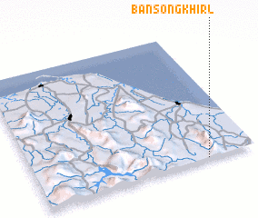 Places with similar names to Ban Song Khirl, Thailand :: Disclaimer :: Information on this page comes without warranty of any kind |
||
|
Where is Ban Song Khirl? Elevation and coordinates ::
Latitude (lat): 6°0'24"N Longitude (lon): 101°46'48"E
Elevation (approx.): 140m (map arrows pan, magnifying glasses zoom) |
||
|
Visiting Ban Song Khirl? Hotel/Accommodation ::
Book a hotel in Ban Song Khirl Travel Guide ::
Buy a travel guide for Thailand rental cars ::
car rental offers GPS waypoint ::
download a GPX waypoint (PoI) of Ban Song Khirl for your GPS receiver
|
||