|
search place name
|
||
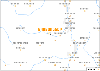
Ban Song Sop (Chiang Rai, Thailand)Ban Song Sop is a town in the Chiang Rai region of Thailand. An overview map of the region around Ban Song Sop is displayed below.
regional and 3d topo map of Ban Song Sop, Thailand ::
Ban Song Sop airports ::
The nearest airport is LPT - Lampang, located 110.4 km south of Ban Song Sop.
Other airports nearby include MOG - Mong Hsat (139.9 km north), THL - Tachilek Tachileik (144.0 km north), PRH - Phrae (146.5 km south east), Nearby towns ::
Ban Hang Tam (2.5km south east) //
Amphoe Wiang Pa Pao (2.5km south east) //
Ban Pa Ngiu (2.5km south east) //
Ban Buak Tao (3.5km east) //
Ban Yang (5.1km south west) //
Ban Hang Tam (5.6km east) //
Ban San Sai (7.2km east) //
Ban Rim Lao (7.2km east) //
Ban Pa Ngiu (7.9km north east) //
Ban Mae Hang (7.9km south east) //
Ban Foei Hai (8.9km north east) //
Ban Pa Bong (10.2km north east) //
Ban Nong Yao (1) (10.2km north east) //
Ban Rim Lao (10.2km north east) //
Ban Fori Hai (10.2km north east) //
Ban Mae Khachan (1) (10.2km south east) //
[all distances 'as the bird flies' and approximate] 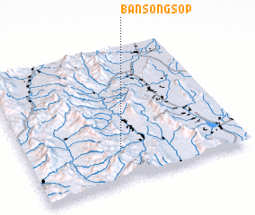 Places with similar names to Ban Song Sop, Thailand ::
// Ban Song Sop (TH)
Disclaimer :: Information on this page comes without warranty of any kind |
||
|
Where is Ban Song Sop? Elevation and coordinates ::
Latitude (lat): 19°16'0"N Longitude (lon): 99°27'0"E
Elevation (approx.): 651m (map arrows pan, magnifying glasses zoom) |
||
|
Visiting Ban Song Sop? Hotel/Accommodation ::
Book a hotel in Ban Song Sop Travel Guide ::
Buy a travel guide for Thailand rental cars ::
car rental offers GPS waypoint ::
download a GPX waypoint (PoI) of Ban Song Sop for your GPS receiver
|
||