|
search place name
|
||
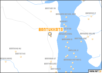
Ban Tukkata (Thailand)Ban Tukkata is a town in Thailand. An overview map of the region around Ban Tukkata is displayed below.
regional and 3d topo map of Ban Tukkata, Thailand ::
Ban Tukkata airports ::
The nearest airport is BKK - Bangkok Intl, located 193.2 km south east of Ban Tukkata.
Nearby towns ::
Amphoe Si Sawat (0.0km north) //
Ban Dan Mae Chalaep (0.0km north) //
Ban Dong Rang (5.2km east) //
Ban Tukkata (1) (5.3km east) //
Ban Phu Nam Prieo (1) (5.4km east) //
Ban Song Saling (5.7km east) //
Ban Khamin (6.3km east) //
Si Sawat (6.4km north east) //
Ban Dan Mae Chalaep (6.5km north east) //
Ban Mae Khamin (1) (6.5km south east) //
Ban Pong Wai (7.5km south east) //
Ban Dan Mae Chalaep (8.9km north east) //
Ban Wang Khamen (9.2km south east) //
Ban Tha Sung (9.2km south east) //
Ban Lum Le (10.2km south east) //
[all distances 'as the bird flies' and approximate]  Places with similar names to Ban Tukkata, Thailand ::
Disclaimer :: Information on this page comes without warranty of any kind |
||
|
Where is Ban Tukkata? Elevation and coordinates ::
Latitude (lat): 14°39'0"N Longitude (lon): 98°59'0"E
Elevation (approx.): 347m (map arrows pan, magnifying glasses zoom) |
||
|
Visiting Ban Tukkata? Hotel/Accommodation ::
Book a hotel in Ban Tukkata Travel Guide ::
Buy a travel guide for Thailand rental cars ::
car rental offers GPS waypoint ::
download a GPX waypoint (PoI) of Ban Tukkata for your GPS receiver
|
||