|
search place name
|
||
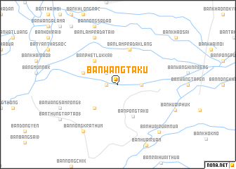
Ban Wang Taku (Phichit, Thailand)Ban Wang Taku is a town in the Phichit region of Thailand. An overview map of the region around Ban Wang Taku is displayed below.
regional and 3d topo map of Ban Wang Taku, Thailand ::
Ban Wang Taku airports ::
The nearest airport is PHS - Phitsanulok, located 88.0 km north of Ban Wang Taku.
Other airports nearby include LOE - Loei (204.4 km north east), NAK - Nakhon Ratchasima Khorat (207.4 km south east), Nearby towns ::
Ban Hong Kruat (1) (1.8km west) //
Ban Huai Khen (1) (2.6km north west) //
Ban Wang Khon Sung (3.6km east) //
Ban Phet Luk Ka(1) (5.1km north west) //
Ban Huai Riang Tai (5.1km south west) //
Ban Pong Tako (5.5km south east) //
Ban Nong Tao (1) (5.7km west) //
Ban Lam Prada Klang (5.8km north) //
Ban Lam Prada Tai (1) (8.2km north west) //
Ban Nong Krathum (9.1km south west) //
Ban Huai Ruam Nua (9.8km south east) //
[all distances 'as the bird flies' and approximate] 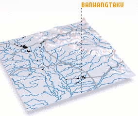 Places with similar names to Ban Wang Taku, Thailand ::
// Ban Wang Tak (TH)
// Ban Wang Ta Kaeo (TH)
// Ban Wang Tako (TH)
// Ban Wang Tako (TH)
// Ban Wang Taku (TH)
// Ban Wang Taku (TH)
Disclaimer :: Information on this page comes without warranty of any kind |
||
|
Where is Ban Wang Taku? Elevation and coordinates ::
Latitude (lat): 16°1'0"N Longitude (lon): 100°30'0"E
Elevation (approx.): 38m (map arrows pan, magnifying glasses zoom) |
||
|
Visiting Ban Wang Taku? Hotel/Accommodation ::
Book a hotel in Ban Wang Taku Travel Guide ::
Buy a travel guide for Thailand rental cars ::
car rental offers GPS waypoint ::
download a GPX waypoint (PoI) of Ban Wang Taku for your GPS receiver
|
||