|
search place name
|
||
Kampong Paho (Pattani, Thailand)Kampong Paho is a town in the Pattani region of Thailand. An overview map of the region around Kampong Paho is displayed below.
regional and 3d topo map of Kampong Paho, Thailand ::

Kampong Paho airports ::
The nearest airport is NAW - Narathiwat, located 21.7 km south east of Kampong Paho.
Other airports nearby include PAN - Pattani (50.4 km west), KBR - Kota Bahru Sultan Ismail Petra (93.9 km south east), HDY - Songkhla Hat Yai Intl (135.7 km west), AOR - Alor Setar Sultan Abdul Halim (140.0 km west), Nearby towns ::
Kampong Hutang Machang (1.8km west) //
Ban Ka Du Nong (2.1km north) //
Ban Bu Re (2.6km north east) //
Ban Khok Wua (4.1km south west) //
Ban Ton Sai (4.1km south east) //
Ban Nai (4.1km north east) //
Ban Manang Da Lam (4.3km north) //
Ban Ta Lo Du Ra Man (4.6km south west) //
Ban Ku Wa (5.0km south east) //
Kampong Kulupang (5.2km north west) //
Ban Ku Wing (5.2km north east) //
Ban Du Lo Dara Bae (5.6km south) //
Ban Cho Ku Yae (5.6km north east) //
Ban Nong Khuk (5.8km west) //
Ban Lo Thu (6.4km west) //
Amphoe Sai Buri (6.7km north east) //
Kapho (7.4km south) //
Ban Bare (7.4km north) //
Bacho (7.6km east) //
Ban Yai (7.6km east) //
Ban Plong Hoi (7.8km south west) //
Kampong Baru (7.8km south west) //
Ban Toiat Nam (8.0km north west) //
Ban Ka Yi (8.2km north east) //
Kampong Chaokapho (8.3km south west) //
Ban Balae (8.2km south east) //
Ban Kalapho (8.3km north west) //
Sai Buri (8.8km north east) //
Ban Balae Nua (9.2km south east) //
[all distances 'as the bird flies' and approximate] 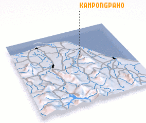 Places with similar names to Kampong Paho, Thailand ::
// Kampong Pahah (MY)
// Kampong Pahu (MY)
// Kampong Pahu (MY)
// Kampong Pahu (MY)
// Kampong Pahu (MY)
// Kampong Pohoi (MY)
// Kampung Pahi (MY)
Disclaimer :: Information on this page comes without warranty of any kind |
||
|
Where is Kampong Paho? Elevation and coordinates ::
Latitude (lat): 6°38'0"N Longitude (lon): 101°35'0"E
Elevation (approx.): 12m (map arrows pan, magnifying glasses zoom) |
||
|
Visiting Kampong Paho? Hotel/Accommodation ::
Book a hotel in Kampong Paho Travel Guide ::
Buy a travel guide for Thailand rental cars ::
car rental offers GPS waypoint ::
download a GPX waypoint (PoI) of Kampong Paho for your GPS receiver
|
||