|
search place name
|
||
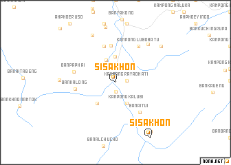
Si Sakhon (Narathiwat, Thailand)Si Sakhon is a town in the Narathiwat region of Thailand. An overview map of the region around Si Sakhon is displayed below.
regional and 3d topo map of Si Sakhon, Thailand ::
Si Sakhon airports ::
The nearest airport is NAW - Narathiwat, located 41.8 km north east of Si Sakhon.
Other airports nearby include PAN - Pattani (72.3 km north west), KBR - Kota Bahru Sultan Ismail Petra (88.1 km east), AOR - Alor Setar Sultan Abdul Halim (122.0 km west), HDY - Songkhla Hat Yai Intl (145.0 km north west), Nearby towns ::
Ban Ka Yo Ma Ti (1.5km south) //
Kampong Rayao Mati (1.9km east) //
Kampong Kalubi (3.9km south east) //
Ban Suan Phlu (3.9km north west) //
Ban Tham Nop (4.2km north) //
Ban Al Tae Tae (4.5km south west) //
Ban Al Chu Na (6.0km north) //
Ban I Ka Lu Pae (6.1km north) //
Ban Ai Tui (6.3km south east) //
Ban Ka Long (6.6km west) //
Ban Pa Phai (6.9km west) //
Kampong Lubobatu (6.9km north east) //
Ban La Weng (8.1km north east) //
Ban Ba Ngo Pa Tae (8.5km north west) //
Kampong Lawen (9.4km north east) //
Ban La O (9.8km south east) //
[all distances 'as the bird flies' and approximate] 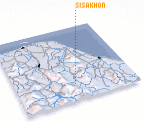 Places with similar names to Si Sakhon, Thailand ::
Disclaimer :: Information on this page comes without warranty of any kind |
||
|
Where is Si Sakhon? Elevation and coordinates ::
Latitude (lat): 6°13'50"N Longitude (lon): 101°29'59"E
Elevation (approx.): 39m (map arrows pan, magnifying glasses zoom) |
||
|
Visiting Si Sakhon? Hotel/Accommodation ::
Book a hotel in Si Sakhon Travel Guide ::
Buy a travel guide for Thailand rental cars ::
car rental offers GPS waypoint ::
download a GPX waypoint (PoI) of Si Sakhon for your GPS receiver
|
||