|
search place name
|
||
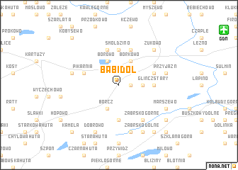
Babi Dół (Poland)Babi Dół is a town in Poland. An overview map of the region around Babi Dół is displayed below.
regional and 3d topo map of Babi Dół, Poland ::
Babi Dół airports ::
The nearest airport is GDN - Gdansk Lecha Walesy, located 13.0 km north east of Babi Dół.
Other airports nearby include OSP - Slupsk Redzikowo (81.0 km west), POZ - Poznan Lawica (231.4 km south west), Nearby towns ::
Krowie Łąki (1.1km east) //
Skrzeszewo Żukowskie (2.2km east) //
Borkowo (3.9km north) //
Borcz (3.9km south) //
Borowo (3.9km north) //
Majdany (5.6km south) //
Glińcz Stary (3.2km east) //
Smołdzino (5.6km north) //
Borkowo (5.7km north) //
Glińcz (3.7km north east) //
Glińcz Nowy (3.7km north east) //
Dzierzążno (3.7km north west) //
Pikarnia (3.7km north west) //
Sitno (5.7km north) //
Ząbrsko Górne (6.0km south) //
Przyjaźń (4.7km north east) //
Huta Górna (7.5km south) //
Mezowo (4.7km north west) //
Żukowo (6.4km north east) //
Marszewo (5.7km south east) //
Ząbrsko Dolne (7.7km south) //
Dobrowo (7.7km south) //
Jodłowno (7.0km south east) //
Pomlewo (8.1km south east) //
Pustkowo (8.6km south east) //
Kamela (8.6km south west) //
Kobysewo (8.6km north west) //
[all distances 'as the bird flies' and approximate] 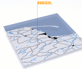 Places with similar names to Babi Dół, Poland ::
// Bobadela (PT)
// Bobadela (PT)
// Bobadela (PT)
// Bobadela (PT)
// Babie Doły (PL)
// Bou Abdallah (TN)
// Bobadela (ES)
// Bobadela (ES)
// Bobadilla (ES)
// Bobadilla (ES)
Disclaimer :: Information on this page comes without warranty of any kind |
||
|
Where is Babi Dół? Elevation and coordinates ::
Latitude (lat): 54°18'0"N Longitude (lon): 18°19'0"E
Elevation (approx.): 196m (map arrows pan, magnifying glasses zoom) |
||
|
Visiting Babi Dół? Hotel/Accommodation ::
Book a hotel in Babi Dół Travel Guide ::
Buy a travel guide for Poland rental cars ::
car rental offers GPS waypoint ::
download a GPX waypoint (PoI) of Babi Dół for your GPS receiver
|
||