|
search place name
|
||
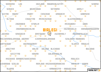
Białęgi (Poland)Białęgi is a town in Poland. An overview map of the region around Białęgi is displayed below.
regional and 3d topo map of Białęgi, Poland ::
Białęgi airports ::
The nearest airport is WAW - Warsaw Okecie, located 83.7 km south east of Białęgi.
Other airports nearby include GDN - Gdansk Lecha Walesy (220.3 km north west), Nearby towns ::
Staroźreby (1.9km north) //
Przedpełce Kiełbasy (1.1km west) //
Przedpełce (1.1km west) //
Przedpełce Włosty (1.9km south) //
Słomkowo (1.9km south) //
Przedpełce Kościołki (2.3km west) //
Opatówiec (2.3km west) //
Zdziar Mały (2.3km east) //
Czerniewo (2.9km south west) //
Worowice-Wyroby (2.9km north east) //
Sochocino-Praga (3.9km south) //
Ostrzykowo (2.9km south east) //
Parcele Bromierzyk (4.3km north east) //
Łoniewo (4.3km south west) //
Mieczyno (5.6km north) //
Mikołajewo (3.4km west) //
Przeciszewo (5.7km north) //
Wołowa (5.7km south) //
Bromierz (5.7km north) //
Blichowo (5.7km south) //
Stoplin (5.0km north west) //
Parcele łubki (5.0km south east) //
Maliszewko (7.4km north) //
Smardzewo (4.5km west) //
Cieszewo (7.5km north) //
Zdziar Wielki (4.9km east) //
Szulbory (4.9km east) //
Golanki Dolne (7.5km south) //
Golanki (7.5km south) //
[all distances 'as the bird flies' and approximate] 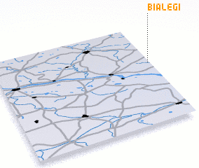 Places with similar names to Białęgi, Poland ::
Disclaimer :: Information on this page comes without warranty of any kind |
||
|
Where is Białęgi? Elevation and coordinates ::
Latitude (lat): 52°37'0"N Longitude (lon): 19°59'0"E
Elevation (approx.): 142m (map arrows pan, magnifying glasses zoom) |
||
|
Visiting Białęgi? Hotel/Accommodation ::
Book a hotel in Białęgi Travel Guide ::
Buy a travel guide for Poland rental cars ::
car rental offers GPS waypoint ::
download a GPX waypoint (PoI) of Białęgi for your GPS receiver
|
||