|
search place name
|
||
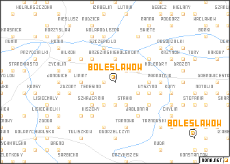
Bolesławów (Poland)Bolesławów is a town in Poland. An overview map of the region around Bolesławów is displayed below.
regional and 3d topo map of Bolesławów, Poland ::
Bolesławów airports ::
The nearest airport is POZ - Poznan Lawica, located 107.7 km west of Bolesławów.
Other airports nearby include WRO - Wroclaw Strachowice (155.8 km south west), KTW - Katowice Pyrzowice (195.0 km south), Nearby towns ::
Potażniki (1.1km west) //
Głodno (2.2km north east) //
Brzezińskie Holendry (3.7km north) //
Reginów (3.7km south) //
Stare Paprockie Holendry (2.9km north east) //
Smolnik (2.9km south east) //
Teresina (2.9km south west) //
Stawki (3.9km south) //
Burbony (3.9km south) //
Nowe Brzeźno (4.3km north west) //
Szwajcaria (4.3km south west) //
Hiszpania (4.3km south west) //
Kałek (3.4km east) //
Lipiny (3.4km west) //
Szczepidło (5.7km north) //
Wyszyna (3.9km south east) //
Jabłonna (6.0km south) //
Kępina (6.0km south) //
Kiszewy (6.0km south) //
Borowo (5.0km north east) //
Brzeźno (5.0km north west) //
Kolonia Wyszyna (5.0km south east) //
Paprotnia (4.5km east) //
Wola Podłężna (7.5km north) //
Kolonia Wilków (4.9km west) //
Tarnowa (7.5km south) //
Beznazwa (4.9km east) //
Grabowiec (7.5km south) //
Żdżary (4.9km west) //
[all distances 'as the bird flies' and approximate]  Places with similar names to Bolesławów, Poland ::
Disclaimer :: Information on this page comes without warranty of any kind |
||
|
Where is Bolesławów? Elevation and coordinates ::
Latitude (lat): 52°10'0"N Longitude (lon): 18°21'0"E
Elevation (approx.): 149m (map arrows pan, magnifying glasses zoom) |
||
|
Visiting Bolesławów? Hotel/Accommodation ::
Book a hotel in Bolesławów Travel Guide ::
Buy a travel guide for Poland rental cars ::
car rental offers GPS waypoint ::
download a GPX waypoint (PoI) of Bolesławów for your GPS receiver
|
||