|
search place name
|
||
Cegielnia Psucka (Poland)Cegielnia Psucka is a town in Poland. An overview map of the region around Cegielnia Psucka is displayed below.
regional and 3d topo map of Cegielnia Psucka, Poland ::

Cegielnia Psucka airports ::
The nearest airport is WAW - Warsaw Okecie, located 44.6 km south of Cegielnia Psucka.
Nearby towns ::
Budy Siennickie (0.0km north) //
Studzianki (1.1km west) //
Pieścirogi Nowe (2.2km north west) //
Wągrodno (2.2km north east) //
Psucin (3.7km south) //
Krogule Budy (2.3km east) //
Pieńki Psuckie (3.9km south) //
Pieścirogi Stare (3.9km north) //
Miekoszyn (2.9km south west) //
Nowa Wieś (3.9km north) //
Siennica (3.9km north) //
Nasielsk (3.9km north) //
Dębinki (3.4km west) //
Kosewo (5.7km north) //
Morgi (3.9km north west) //
Ruszkowo (5.0km north west) //
Chlebiotki (6.0km north) //
Czarnowo (7.4km south) //
Żabiczyn (4.5km east) //
Mazewo Włośeiańskie (7.4km north) //
Zaborze (4.9km west) //
Mazewo Dworskie (7.5km north) //
Mazewo (7.5km north) //
Kikoły (7.5km south) //
Pianowo Bargły (7.5km north) //
Konary (6.5km north west) //
Toruń (5.8km south west) //
Malczyn (5.8km north west) //
Kątne (7.7km north) //
[all distances 'as the bird flies' and approximate] 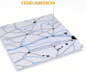 Places with similar names to Cegielnia Psucka, Poland :: Disclaimer :: Information on this page comes without warranty of any kind |
||
|
Where is Cegielnia Psucka? Elevation and coordinates ::
Latitude (lat): 52°33'0"N Longitude (lon): 20°47'0"E
Elevation (approx.): 108m (map arrows pan, magnifying glasses zoom) |
||
|
Visiting Cegielnia Psucka? Hotel/Accommodation ::
Book a hotel in Cegielnia Psucka Travel Guide ::
Buy a travel guide for Poland rental cars ::
car rental offers GPS waypoint ::
download a GPX waypoint (PoI) of Cegielnia Psucka for your GPS receiver
|
||