|
search place name
|
||
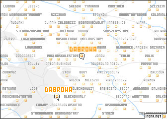
Dąbrowa (Poland)Dąbrowa is a town in Poland. An overview map of the region around Dąbrowa is displayed below.
regional and 3d topo map of Dąbrowa, Poland ::
Dąbrowa airports ::
The nearest airport is WAW - Warsaw Okecie, located 103.7 km north east of Dąbrowa.
Other airports nearby include KTW - Katowice Pyrzowice (153.2 km south), KRK - Krakow Balice (194.1 km south), Nearby towns ::
Kalonka (1.9km north) //
Moskuliki (1.1km west) //
Imielnik Nowy (2.2km north west) //
Wilanów (2.2km north west) //
Janów (2.3km east) //
Budy (3.7km south) //
Moskule Stare (2.3km west) //
Imielnik Stary (3.9km north) //
Grabina (2.9km north east) //
Dobra Nowiny (3.9km north) //
Nowosolna (2.9km south east) //
Dobieszków (4.4km north east) //
Moskule Nowe (4.4km north west) //
Stoki (4.4km south west) //
Janów (5.6km south) //
Łukaszew (3.4km west) //
Dobra (5.6km north) //
Mileszki (5.7km south) //
Boginia (3.9km north east) //
Widzew (5.7km south) //
Henryków (5.7km south) //
Antoniew Sikawa (3.9km south west) //
Wiączyn Górny (6.0km south) //
Popielarnia (6.0km south) //
Modrzew (5.1km north west) //
Wiączyn Dolny (5.1km south east) //
Kiełmina (6.0km north) //
Sosnowiec (7.4km north) //
Plichtów (4.6km east) //
[all distances 'as the bird flies' and approximate] 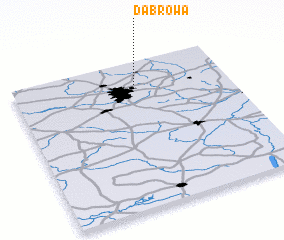 Places with similar names to Dąbrowa, Poland ::
Disclaimer :: Information on this page comes without warranty of any kind |
||
|
Where is Dąbrowa? Elevation and coordinates ::
Latitude (lat): 51°49'0"N Longitude (lon): 19°34'0"E
Elevation (approx.): 240m (map arrows pan, magnifying glasses zoom) |
||
|
Visiting Dąbrowa? Hotel/Accommodation ::
Book a hotel in Dąbrowa Travel Guide ::
Buy a travel guide for Poland rental cars ::
car rental offers GPS waypoint ::
download a GPX waypoint (PoI) of Dąbrowa for your GPS receiver
|
||