|
search place name
|
||
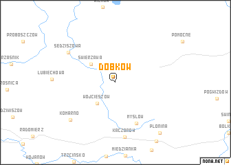
Dobków (Dolnośląskie, Poland)Dobków is a town in the Dolnośląskie region of Poland. An overview map of the region around Dobków is displayed below.
regional and 3d topo map of Dobków, Poland ::
Dobków airports ::
The nearest airport is WRO - Wroclaw Strachowice, located 67.8 km east of Dobków.
Other airports nearby include BBJ - Bautzen (101.7 km west), PED - Pardubice (109.5 km south), IEG - Zielona Gora Babimost (128.1 km north), PRG - Prague Ruzyne (154.5 km south west), Nearby towns ::
Wojcieszów (3.9km south west) //
Świerzawa (3.9km north west) //
Mysłow (7.0km south) //
Kaczorów (8.9km south) //
Sędziszowa (6.8km north west) //
Komarno (7.6km south west) //
Płonina (9.3km south east) //
[all distances 'as the bird flies' and approximate] 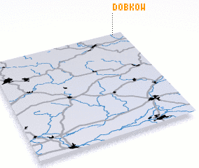 Places with similar names to Dobków, Poland ::
Disclaimer :: Information on this page comes without warranty of any kind |
||
|
Where is Dobków? Elevation and coordinates ::
Latitude (lat): 50°59'24"N Longitude (lon): 15°56'7"E
Elevation (approx.): 330m (map arrows pan, magnifying glasses zoom) |
||
|
Visiting Dobków? Hotel/Accommodation ::
Book a hotel in Dobków Travel Guide ::
Buy a travel guide for Poland rental cars ::
car rental offers GPS waypoint ::
download a GPX waypoint (PoI) of Dobków for your GPS receiver
|
||