|
search place name
|
||
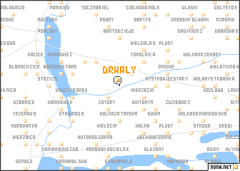
Drwały (Poland)Drwały is a town in Poland. An overview map of the region around Drwały is displayed below.
regional and 3d topo map of Drwały, Poland ::
Drwały airports ::
The nearest airport is WAW - Warsaw Okecie, located 54.4 km south of Drwały.
Nearby towns ::
Kępa Zatorska (2.2km south west) //
Cieńsza (2.2km north east) //
Mierzęcin (2.9km south east) //
Mystkówiec Szczuczyn (2.9km south east) //
Zatory (3.9km south) //
Wiktoryn (4.3km south east) //
Gładczyn Szlachecki (4.3km north west) //
Topolnica (4.3km north east) //
Wólka Zatorska (5.6km south) //
Mystkówiec Kalinówka (3.4km east) //
Ciski (5.0km south east) //
Wielgolas (6.0km north) //
Borsuki Nowe (5.0km north west) //
Mystkówiec Stary (4.5km east) //
Bartodzieje (7.4km north) //
Wielęcin (7.5km south) //
Burlaki (4.9km west) //
Kruczy Borek (4.9km west) //
Borsuki (4.9km west) //
Pniewo (4.9km east) //
Suwin (6.5km south east) //
Wólka (7.7km south) //
Lutobrok (5.8km north east) //
Stawinoga (7.2km south west) //
Płusy (7.2km north east) //
Płudy (8.7km south east) //
[all distances 'as the bird flies' and approximate]  Places with similar names to Drwały, Poland ::
Disclaimer :: Information on this page comes without warranty of any kind |
||
|
Where is Drwały? Elevation and coordinates ::
Latitude (lat): 52°38'0"N Longitude (lon): 21°12'0"E
Elevation (approx.): 89m (map arrows pan, magnifying glasses zoom) |
||
|
Visiting Drwały? Hotel/Accommodation ::
Book a hotel in Drwały Travel Guide ::
Buy a travel guide for Poland rental cars ::
car rental offers GPS waypoint ::
download a GPX waypoint (PoI) of Drwały for your GPS receiver
|
||