|
search place name
|
||
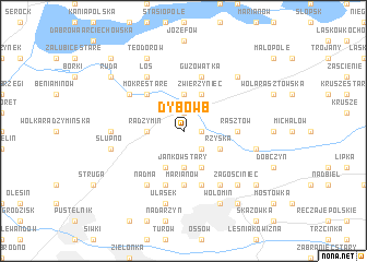
Dybów B (Poland)Dybów B is a town in Poland. An overview map of the region around Dybów B is displayed below.
regional and 3d topo map of Dybów B, Poland ::
Dybów B airports ::
The nearest airport is WAW - Warsaw Okecie, located 32.7 km south west of Dybów B.
Nearby towns ::
Dybów A (1.9km north) //
Wiktorów (1.1km east) //
Dybów (1.9km north) //
Kraszew Dzielny (2.2km south east) //
Zawady (3.7km north) //
Radzymin (2.3km west) //
Janków Stary (3.7km south) //
Zwierzyniec (3.9km north) //
Kołaków (3.9km north) //
Rżyska (2.9km south east) //
Helenów (3.9km south) //
Ciemne (3.9km south) //
Mokre Stare (4.3km north west) //
Mokre (4.3km north west) //
Marianów (5.6km south) //
Czarna (5.6km south) //
Kraszew Stary (3.4km east) //
Rasztów (3.4km east) //
Czarna Mała (5.7km south) //
Guzowatka (5.7km north) //
Czarna Duża (5.7km south) //
Nowa Wieś (6.0km south) //
Mokre Nowe (5.0km north west) //
Łoś (6.0km north) //
Janków Nowy (6.0km south) //
Nadma (6.0km south) //
Aleksandrów (4.5km west) //
Kraszew Nowy (4.9km east) //
Ulasek (7.5km south) //
[all distances 'as the bird flies' and approximate] 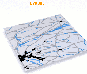 Places with similar names to Dybów B, Poland ::
Disclaimer :: Information on this page comes without warranty of any kind |
||
|
Where is Dybów B? Elevation and coordinates ::
Latitude (lat): 52°25'0"N Longitude (lon): 21°13'0"E
Elevation (approx.): 86m (map arrows pan, magnifying glasses zoom) |
||
|
Visiting Dybów B? Hotel/Accommodation ::
Book a hotel in Dybów B Travel Guide ::
Buy a travel guide for Poland rental cars ::
car rental offers GPS waypoint ::
download a GPX waypoint (PoI) of Dybów B for your GPS receiver
|
||