|
search place name
|
||
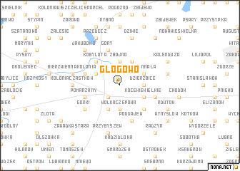
Głogowo (Poland)Głogowo is a town in Poland. An overview map of the region around Głogowo is displayed below.
regional and 3d topo map of Głogowo, Poland ::
Głogowo airports ::
The nearest airport is KTW - Katowice Pyrzowice, located 199.7 km south of Głogowo.
Nearby towns ::
Kłodawa (2.2km south west) //
Zbójno (3.7km north) //
Dzierzbice (2.3km east) //
Wólka Czepowa (3.7km south) //
Dębina (2.9km north west) //
Bierzwienna Długa (2.9km north west) //
Długie (3.9km north) //
Kłokoszyn (3.9km north) //
Kaleń Mała (2.9km north east) //
Józefów-Guzowski (3.9km south) //
Kocewie Wielkie (2.9km south east) //
Kobylata (4.3km north west) //
Rgielew (4.3km south east) //
Góry (5.7km north) //
Bierzwienna (3.9km north west) //
Aleksandrów (3.9km south east) //
Pomarzany (3.9km south west) //
Podgajew (5.7km south) //
Górki (5.0km south west) //
Kolonia Cząstków (4.5km west) //
Bierzwienna Kolonia (4.9km west) //
Dziwie (7.5km north) //
Przybyszew (7.5km south) //
Dzierzbice (4.9km east) //
Jakubowo (6.5km north west) //
Przedecz (7.8km north) //
Jasieniec (5.9km north east) //
Kaleń Duża (5.9km north east) //
Rdutów (5.9km south east) //
[all distances 'as the bird flies' and approximate] 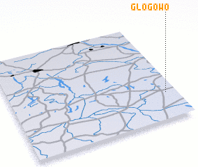 Places with similar names to Głogowo, Poland ::
Disclaimer :: Information on this page comes without warranty of any kind |
||
|
Where is Głogowo? Elevation and coordinates ::
Latitude (lat): 52°16'0"N Longitude (lon): 18°56'0"E
Elevation (approx.): 116m (map arrows pan, magnifying glasses zoom) |
||
|
Visiting Głogowo? Hotel/Accommodation ::
Book a hotel in Głogowo Travel Guide ::
Buy a travel guide for Poland rental cars ::
car rental offers GPS waypoint ::
download a GPX waypoint (PoI) of Głogowo for your GPS receiver
|
||