|
search place name
|
||
Kolonia Pokaniewo (Poland)Kolonia Pokaniewo is a town in Poland. An overview map of the region around Kolonia Pokaniewo is displayed below.
regional and 3d topo map of Kolonia Pokaniewo, Poland ::
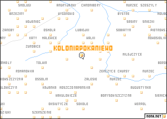
Nearby towns ::
Zabłocie (2.2km south east) //
Choroszczewo (3.7km north) //
Hornowszczyzna (2.3km west) //
Pokaniewo-Ostrówek (2.3km east) //
Wałki (3.9km north) //
Pokaniewo (2.9km north east) //
Lubiejki (5.6km north) //
Grabarka (3.9km north east) //
Zalesie (5.7km south) //
Jasienówka Stara (5.0km north west) //
Hornowo (5.0km north west) //
Klimkowicze (5.0km north east) //
Żerczyce (5.0km south east) //
Jasienówka Mała (4.9km west) //
Moszczona Pańska (7.5km south) //
Kościukowicże (6.5km north east) //
Malewice (5.8km north west) //
Osmola (7.2km north west) //
Nurzec (7.2km south east) //
Kajanka (8.7km south west) //
[all distances 'as the bird flies' and approximate] 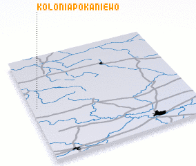 Places with similar names to Kolonia Pokaniewo, Poland :: Disclaimer :: Information on this page comes without warranty of any kind |
||
|
Where is Kolonia Pokaniewo? Elevation and coordinates ::
Latitude (lat): 52°31'0"N Longitude (lon): 23°2'0"E
Elevation (approx.): 173m (map arrows pan, magnifying glasses zoom) |
||
|
Visiting Kolonia Pokaniewo? Hotel/Accommodation ::
Book a hotel in Kolonia Pokaniewo Travel Guide ::
Buy a travel guide for Poland rental cars ::
car rental offers GPS waypoint ::
download a GPX waypoint (PoI) of Kolonia Pokaniewo for your GPS receiver
|
||