|
search place name
|
||
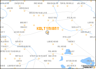
Kołtyniany (Poland)Kołtyniany is a town in Poland. An overview map of the region around Kołtyniany is displayed below.
regional and 3d topo map of Kołtyniany, Poland ::
Kołtyniany airports ::
The nearest airport is GDN - Gdansk Lecha Walesy, located 81.1 km north west of Kołtyniany.
Other airports nearby include KGD - Kaliningrad Khrabrovo (129.8 km north east), WAW - Warsaw Okecie (221.4 km south east), Nearby towns ::
Lubochowo (3.9km south) //
Kwietniewo (5.6km north) //
Kwietnik (5.7km north) //
Wopity (3.8km north east) //
Święty Gaj (4.9km north west) //
Folwark (7.5km south) //
Myślice (4.7km south east) //
Stare Dolno (7.5km north) //
Milikowo (6.5km south east) //
Brudzędy Wielkie (7.7km north) //
Przezmark (8.1km south east) //
Brudzędy Małe (8.1km north west) //
[all distances 'as the bird flies' and approximate]  Places with similar names to Kołtyniany, Poland ::
// Kaltanėnai (LT)
// Kaltinėnai (LT)
// Colţăneni (RO)
// Caldueñín (ES)
// Galdaniān (PK)
// Kildānīn (SY)
// Kildonan (CA)
// Kildonan (CA)
// Kildonan (GB)
// Kildonan (GB)
Disclaimer :: Information on this page comes without warranty of any kind |
||
|
Where is Kołtyniany? Elevation and coordinates ::
Latitude (lat): 53°56'0"N Longitude (lon): 19°27'0"E
Elevation (approx.): 92m (map arrows pan, magnifying glasses zoom) |
||
|
Visiting Kołtyniany? Hotel/Accommodation ::
Book a hotel in Kołtyniany Travel Guide ::
Buy a travel guide for Poland rental cars ::
car rental offers GPS waypoint ::
download a GPX waypoint (PoI) of Kołtyniany for your GPS receiver
|
||