|
search place name
|
||
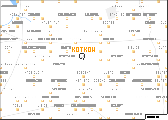
Kotków (Poland)Kotków is a town in Poland. An overview map of the region around Kotków is displayed below.
regional and 3d topo map of Kotków, Poland ::
Kotków airports ::
The nearest airport is WAW - Warsaw Okecie, located 132.4 km east of Kotków.
Other airports nearby include KTW - Katowice Pyrzowice (193.9 km south), Nearby towns ::
Wygorzele (2.2km south east) //
Wymysłów (2.3km west) //
Sobótka (3.7km south) //
Bowyczyn Towarzystwo (2.3km east) //
Rdutów (2.9km north west) //
Chodów (3.9km north) //
Elizanów (2.9km north east) //
Leonów Chrzanowo (4.3km north east) //
Ksawerów (5.6km south) //
Bowyczyn (3.4km east) //
Radzyń (3.9km south west) //
Stanisławów (5.7km north) //
Aleksandrów (5.0km north west) //
Pniewo (5.0km north east) //
Odechów (6.0km south) //
Łubno (5.0km south east) //
Koserz (6.0km north) //
Kurza Jama (7.4km south) //
Wychny (4.5km east) //
Rgielew (4.9km west) //
Ostrówek (6.5km south west) //
Jastrzębia (6.5km south west) //
Kocewie Wielkie (5.9km north west) //
Dzierzbice (7.8km north) //
Dzierzbice (7.2km north west) //
Zgórze (8.2km north east) //
Srebrna (8.2km south west) //
Rybniki (8.2km south west) //
Zieleniew (7.2km south east) //
[all distances 'as the bird flies' and approximate]  Places with similar names to Kotków, Poland ::
Disclaimer :: Information on this page comes without warranty of any kind |
||
|
Where is Kotków? Elevation and coordinates ::
Latitude (lat): 52°13'0"N Longitude (lon): 19°2'0"E
Elevation (approx.): 121m (map arrows pan, magnifying glasses zoom) |
||
|
Visiting Kotków? Hotel/Accommodation ::
Book a hotel in Kotków Travel Guide ::
Buy a travel guide for Poland rental cars ::
car rental offers GPS waypoint ::
download a GPX waypoint (PoI) of Kotków for your GPS receiver
|
||