|
search place name
|
||
Kożniewo Średnie (Poland)Kożniewo Średnie is a town in Poland. An overview map of the region around Kożniewo Średnie is displayed below.
regional and 3d topo map of Kożniewo Średnie, Poland ::

Kożniewo Średnie airports ::
The nearest airport is WAW - Warsaw Okecie, located 66.7 km south of Kożniewo Średnie.
Nearby towns ::
Kożniewo Wielkie (1.1km east) //
Kożniewo Łysaki (2.2km north west) //
Ślubowo (3.7km south) //
Kałęczyn (3.7km south) //
Gąsocin (2.9km south west) //
Marusy (3.9km north) //
Sońsk (4.3km north west) //
Bylice (5.6km south) //
Janówko (3.4km west) //
Ciemniewo (5.7km north) //
Sobklęszcz (3.8km south west) //
Gortaty (3.8km south east) //
Gaj (6.0km south) //
Godacze (6.0km south) //
Godacze Dolne (6.0km south) //
Kościesze (5.0km south east) //
Gołotczyzna (5.0km north west) //
Ciemniewko (7.4km north) //
Wyrzyki (7.4km south) //
Wyrzyki Duże (7.4km south) //
Wyrzyki Małe (7.5km south) //
Olszewka (7.5km north) //
Słończewo Kościesze (4.9km east) //
Wola Ostaszewska (4.9km east) //
Komory Błotne (4.9km west) //
Słończewo (4.9km east) //
Słończewo Gotardy (4.9km east) //
Kubice (6.5km south west) //
Godacze Górne (6.5km south east) //
[all distances 'as the bird flies' and approximate] 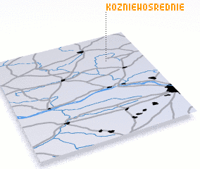 Places with similar names to Kożniewo Średnie, Poland :: Disclaimer :: Information on this page comes without warranty of any kind |
||
|
Where is Kożniewo Średnie? Elevation and coordinates ::
Latitude (lat): 52°45'0"N Longitude (lon): 20°45'0"E
Elevation (approx.): 109m (map arrows pan, magnifying glasses zoom) |
||
|
Visiting Kożniewo Średnie? Hotel/Accommodation ::
Book a hotel in Kożniewo Średnie Travel Guide ::
Buy a travel guide for Poland rental cars ::
car rental offers GPS waypoint ::
download a GPX waypoint (PoI) of Kożniewo Średnie for your GPS receiver
|
||