|
search place name
|
||
Księżostany (Poland)Księżostany is a town in Poland. An overview map of the region around Księżostany is displayed below.
regional and 3d topo map of Księżostany, Poland ::

Księżostany airports ::
The nearest airport is LWO - Lvov Lviv Intl, located 97.4 km south east of Księżostany.
Other airports nearby include RZE - Rzeszow Jasionka (114.3 km south west), Nearby towns ::
Krzywystok (1.9km north) //
Dąbrowa (1.9km south) //
Kolonia Krzywy Stok (2.2km north east) //
Majdan Krynicki (2.2km south west) //
Huta Komarowska (2.2km south west) //
Janówka (3.0km south east) //
Majdan Sielec (3.0km south east) //
Wólka Łabuńska (3.0km north west) //
Ruszczyzna (4.4km north east) //
Krynice (4.4km south west) //
Komarów (3.5km east) //
Huta Dzierążnia (5.6km south) //
Polanówka (4.0km south west) //
Budy Dzierążnia (5.7km south) //
Kolonia Wolica Śniatycka (6.0km north east) //
Antoniówka (5.1km north east) //
Łabunie (5.1km north west) //
Kryniczki (5.1km south west) //
Karolówka (5.1km south east) //
Dzierążnia (5.1km south east) //
Brudek (7.4km north) //
Komarów (5.1km east) //
Polany (5.1km west) //
Sumin (7.5km south) //
Antoniówka Nowa (6.6km north east) //
Wolica Śniatycka (6.6km north east) //
Antoniówka (6.6km south west) //
Antoniówka Stara (6.0km north east) //
Sielec (6.0km south east) //
[all distances 'as the bird flies' and approximate] 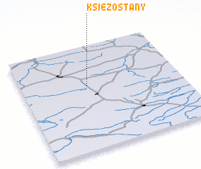 Places with similar names to Księżostany, Poland ::
// Kiszsidány (HU)
Disclaimer :: Information on this page comes without warranty of any kind |
||
|
Where is Księżostany? Elevation and coordinates ::
Latitude (lat): 50°37'0"N Longitude (lon): 23°25'0"E
Elevation (approx.): 252m (map arrows pan, magnifying glasses zoom) |
||
|
Visiting Księżostany? Hotel/Accommodation ::
Book a hotel in Księżostany Travel Guide ::
Buy a travel guide for Poland rental cars ::
car rental offers GPS waypoint ::
download a GPX waypoint (PoI) of Księżostany for your GPS receiver
|
||