|
search place name
|
||
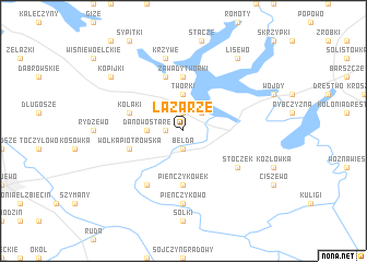
Łazarze (Poland)Łazarze is a town in Poland. An overview map of the region around Łazarze is displayed below.
regional and 3d topo map of Łazarze, Poland ::
Łazarze airports ::
The nearest airport is WAW - Warsaw Okecie, located 203.6 km south west of Łazarze.
Nearby towns ::
Skrodzkie (1.9km north) //
Danowo Nowe (1.1km west) //
Turczyn (1.1km west) //
Bełda (1.9km south) //
Kosiły (2.2km north east) //
Czarna Wieś (2.2km north east) //
Tworki (3.7km north) //
Danowo (2.2km west) //
Danowo Stare (2.2km west) //
Zawady-Tworki (5.6km north) //
Pieńczykówek (5.6km south) //
Zawady (5.7km north) //
Kołaki (3.8km north west) //
Wólka Piotrowska (3.8km south west) //
Miecze (3.8km south west) //
Stoczek (5.0km south east) //
Łamane Grądy (6.0km south) //
Pieńczykowo (7.4km south) //
Krzywe (7.5km north) //
Kopijki (7.1km north west) //
Lisewo (8.1km north east) //
[all distances 'as the bird flies' and approximate] 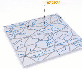 Places with similar names to Łazarze, Poland ::
// Lausers (DE)
// Los Cerros (PA)
// Los Cerros (PA)
// Los Cerros (PA)
// Los Ríos (PA)
// Los Ríos (PA)
// Los Ríos (PA)
// Laceiras (PT)
// Laceiras (PT)
// Laceiras (PT)
Disclaimer :: Information on this page comes without warranty of any kind |
||
|
Where is Łazarze? Elevation and coordinates ::
Latitude (lat): 53°42'0"N Longitude (lon): 22°37'0"E
Elevation (approx.): 120m (map arrows pan, magnifying glasses zoom) |
||
|
Visiting Łazarze? Hotel/Accommodation ::
Book a hotel in Łazarze Travel Guide ::
Buy a travel guide for Poland rental cars ::
car rental offers GPS waypoint ::
download a GPX waypoint (PoI) of Łazarze for your GPS receiver
|
||