|
search place name
|
||
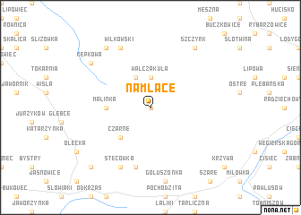
Na Młace (Poland)Na Młace is a town in Poland. An overview map of the region around Na Młace is displayed below.
regional and 3d topo map of Na Młace, Poland ::
Na Młace airports ::
The nearest airport is OSR - Ostrava Mosnov, located 63.2 km west of Na Młace.
Other airports nearby include KRK - Krakow Balice (74.7 km north east), KTW - Katowice Pyrzowice (91.9 km north), TAT - Poprad Tatry (111.6 km south east), SLD - Sliac (113.1 km south), Nearby towns ::
Cyrla (0.0km north) //
Walczakula (3.7km north) //
Salmopol (3.9km north) //
Czarne (4.4km south west) //
Malinka (3.6km west) //
Skała Mała (7.5km south) //
Wilkowski (7.8km north) //
Stecówka (7.8km south) //
Kępkowa (7.3km north west) //
Szczyrk (8.2km north east) //
Brenna (8.2km north west) //
Andziełówka (8.8km south west) //
[all distances 'as the bird flies' and approximate] 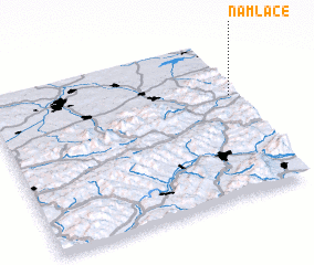 Places with similar names to Na Młace, Poland ::
// Namlos (AT)
// Nameless (US)
// Neu Mohlis (DE)
// Nõmmealuse (EE)
// Nămoloasa (RO)
// Nam Lasi (IQ)
// Nameless (US)
// Namalesse (MZ)
// Namelissa (MZ)
// Namuilásse (MZ)
Disclaimer :: Information on this page comes without warranty of any kind |
||
|
Where is Na Młace? Elevation and coordinates ::
Latitude (lat): 49°39'0"N Longitude (lon): 18°59'0"E
Elevation (approx.): 895m (map arrows pan, magnifying glasses zoom) |
||
|
Visiting Na Młace? Hotel/Accommodation ::
Book a hotel in Na Młace Travel Guide ::
Buy a travel guide for Poland rental cars ::
car rental offers GPS waypoint ::
download a GPX waypoint (PoI) of Na Młace for your GPS receiver
|
||