|
search place name
|
||
Ożarów (Poland)Ożarów is a town in Poland. An overview map of the region around Ożarów is displayed below.
regional and 3d topo map of Ożarów, Poland ::

Ożarów airports ::
The nearest airport is RZE - Rzeszow Jasionka, located 112.1 km south of Ożarów.
Other airports nearby include WAW - Warsaw Okecie (135.1 km north west), Nearby towns ::
Ożarów Drugi (0.0km north) //
Elżbieta (1.9km north) //
Ożarów Pierwszy (1.2km west) //
Góry (2.2km north east) //
Opole Lubelskie (3.9km north) //
Franciszków Stary (3.0km south east) //
Wrzelowiec (3.9km south) //
Kluczkowice (3.9km south) //
Socha (3.5km west) //
Leonin (3.5km east) //
Majdan Borzechowski (3.5km east) //
Górna Owczarnia (4.0km north east) //
Niezdów (5.7km north) //
Franciszków (4.0km south east) //
Cwiętalka (5.7km south) //
Widły (5.7km south) //
Zadole (5.7km south) //
Piszczek (5.1km north east) //
Kolonia Czołna (5.1km north east) //
Zagrody (6.0km north east) //
Świdry (6.0km south west) //
Franciszków Nowy (5.1km south east) //
Grobla (7.4km north) //
Kamionka (4.7km west) //
Spławy (7.5km south) //
Niesiołowice (7.5km south) //
Zajączków (6.6km north east) //
Wola Rudzka (7.8km north) //
Stanisławów (6.0km south east) //
[all distances 'as the bird flies' and approximate] 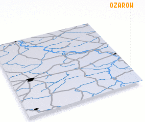 Places with similar names to Ożarów, Poland ::
Disclaimer :: Information on this page comes without warranty of any kind |
||
|
Where is Ożarów? Elevation and coordinates ::
Latitude (lat): 51°7'0"N Longitude (lon): 21°57'0"E
Elevation (approx.): 197m (map arrows pan, magnifying glasses zoom) |
||
|
Visiting Ożarów? Hotel/Accommodation ::
Book a hotel in Ożarów Travel Guide ::
Buy a travel guide for Poland rental cars ::
car rental offers GPS waypoint ::
download a GPX waypoint (PoI) of Ożarów for your GPS receiver
|
||