|
search place name
|
||
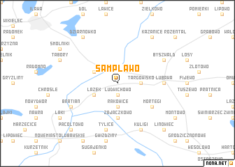
Sampławo (Poland)Sampławo is a town in Poland. An overview map of the region around Sampławo is displayed below.
regional and 3d topo map of Sampławo, Poland ::
Sampławo airports ::
The nearest airport is GDN - Gdansk Lecha Walesy, located 126.2 km north west of Sampławo.
Other airports nearby include KGD - Kaliningrad Khrabrovo (165.7 km north), WAW - Warsaw Okecie (171.8 km south east), Nearby towns ::
Ludwichowo (1.9km south) //
Jakóbkowo (3.7km south) //
Rakowice (3.7km south) //
Targowisko (2.2km east) //
Biała Góra (2.9km north west) //
Łążek (2.9km south west) //
Zajączkowo (5.6km south) //
Mortęgi (5.0km south east) //
Lubawa (4.4km east) //
Tylice (7.5km south) //
Bratian (5.8km south west) //
Byszwałd (5.8km north east) //
Kuligi (7.7km south) //
Kazanice (8.1km north east) //
Dziarnówko (8.1km north west) //
PacołTowo (8.6km south west) //
Linowiec (8.6km south east) //
[all distances 'as the bird flies' and approximate] 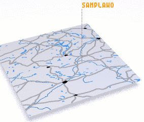
Disclaimer :: Information on this page comes without warranty of any kind |
||
|
Where is Sampławo? Elevation and coordinates ::
Latitude (lat): 53°30'0"N Longitude (lon): 19°41'0"E
Elevation (approx.): 103m (map arrows pan, magnifying glasses zoom) |
||
|
Visiting Sampławo? Hotel/Accommodation ::
Book a hotel in Sampławo Travel Guide ::
Buy a travel guide for Poland rental cars ::
car rental offers GPS waypoint ::
download a GPX waypoint (PoI) of Sampławo for your GPS receiver
|
||