|
search place name
|
||
Skórzewa (Poland)Skórzewa is a town in Poland. An overview map of the region around Skórzewa is displayed below.
regional and 3d topo map of Skórzewa, Poland ::

Skórzewa airports ::
The nearest airport is WAW - Warsaw Okecie, located 102.2 km east of Skórzewa.
Other airports nearby include KTW - Katowice Pyrzowice (203.2 km south), Nearby towns ::
Przyzorz (1.9km north) //
Muchnice (2.2km north west) //
Stanisławów (2.2km south east) //
Dąbkowice (2.2km north east) //
Marianów (2.3km west) //
Jaworzyna (2.3km east) //
Kamienna (3.9km south) //
Wola Owsiana (4.3km south east) //
Długołęka (5.6km north) //
Muchnów (3.4km west) //
Dobrzewy (3.9km south east) //
Janiszew (3.9km south west) //
Podgajew (5.7km south) //
Swoboda Trębska (3.9km north east) //
Pobórz (3.9km north east) //
Szczyt (5.7km south) //
Niedrzaków (6.0km north) //
Komadzyn (5.0km south west) //
Szymanówka (6.0km south) //
Wola Trębska (6.0km north) //
Wola Prosperowa (6.0km south) //
Kaszewy Tarnowskie (7.4km south) //
Nowa Wieś (7.4km north) //
Kurów (4.5km east) //
Skrzany (7.4km north) //
Wierzbie Towarzystwo (4.9km west) //
Kaszewy Dworne (7.5km south) //
Rejmontów (4.9km west) //
Złotniki (7.5km south) //
[all distances 'as the bird flies' and approximate] 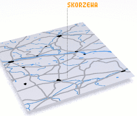 Places with similar names to Skórzewa, Poland ::
Disclaimer :: Information on this page comes without warranty of any kind |
||
|
Where is Skórzewa? Elevation and coordinates ::
Latitude (lat): 52°17'0"N Longitude (lon): 19°29'0"E
Elevation (approx.): 108m (map arrows pan, magnifying glasses zoom) |
||
|
Visiting Skórzewa? Hotel/Accommodation ::
Book a hotel in Skórzewa Travel Guide ::
Buy a travel guide for Poland rental cars ::
car rental offers GPS waypoint ::
download a GPX waypoint (PoI) of Skórzewa for your GPS receiver
|
||