|
search place name
|
||
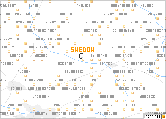
Swędów (Poland)Swędów is a town in Poland. An overview map of the region around Swędów is displayed below.
regional and 3d topo map of Swędów, Poland ::
Swędów airports ::
The nearest airport is WAW - Warsaw Okecie, located 101.1 km east of Swędów.
Other airports nearby include KTW - Katowice Pyrzowice (163.8 km south), KRK - Krakow Balice (205.2 km south), Nearby towns ::
Anielin (0.0km north) //
Kolonia Osse (1.9km north) //
Kolonia Tymianka (1.1km east) //
Osse (2.2km north east) //
Sosnowiec Górny (2.2km south east) //
Tymianka (2.3km east) //
Kębliny (2.9km north west) //
Ciołek (3.9km north) //
Szczawin (2.9km south west) //
Sosnowiec (3.9km south) //
Zelgoszcz (3.9km south) //
Koźle (4.4km north east) //
Sosnowiec Dolny (4.4km south east) //
Czaplinek (4.4km south west) //
Gozdów Nowy (5.6km north) //
Dobra (5.7km south) //
Gozdów Stary (5.7km north) //
Gozdów (5.7km north) //
Wrzask (5.7km north) //
Kiełmina (5.7km south) //
Smolice (3.9km south east) //
Stryków (3.9km south east) //
Sadówka (6.0km north) //
Biesiekierz Górzewo (6.0km north) //
Józefów (6.0km south) //
Biesiekierz Rudny (5.0km north west) //
Glinnik (5.1km south west) //
Dobra Nowiny (7.4km south) //
Moskule Nowe (7.5km south) //
[all distances 'as the bird flies' and approximate]  Places with similar names to Swędów, Poland ::
Disclaimer :: Information on this page comes without warranty of any kind |
||
|
Where is Swędów? Elevation and coordinates ::
Latitude (lat): 51°55'0"N Longitude (lon): 19°33'0"E
Elevation (approx.): 149m (map arrows pan, magnifying glasses zoom) |
||
|
Visiting Swędów? Hotel/Accommodation ::
Book a hotel in Swędów Travel Guide ::
Buy a travel guide for Poland rental cars ::
car rental offers GPS waypoint ::
download a GPX waypoint (PoI) of Swędów for your GPS receiver
|
||