|
search place name
|
||
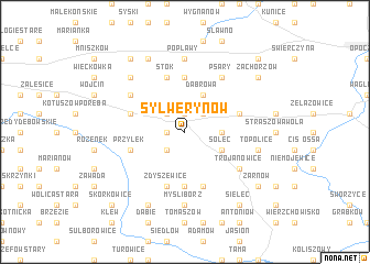
Sylwerynów (Poland)Sylwerynów is a town in Poland. An overview map of the region around Sylwerynów is displayed below.
regional and 3d topo map of Sylwerynów, Poland ::
Sylwerynów airports ::
The nearest airport is WAW - Warsaw Okecie, located 112.8 km north east of Sylwerynów.
Other airports nearby include KTW - Katowice Pyrzowice (117.3 km south west), KRK - Krakow Balice (138.0 km south), RZE - Rzeszow Jasionka (188.6 km south east), Nearby towns ::
Paradyż (1.2km west) //
Kazimierzów (1.9km north) //
Wielka Wola (2.2km north east) //
Joaniów (2.2km south west) //
Feliksów (2.2km north west) //
Daleszewice (2.3km east) //
Alfonsów (3.9km north) //
Dąbrowa (3.9km north) //
Solec (3.0km south east) //
Budków (3.0km south east) //
Dłużniewice (5.6km south) //
Kolonia Popławy (5.6km north) //
Pilichowice (5.7km south) //
Zdyszewice (5.7km south) //
Widuch (5.7km south) //
Przyłęk (3.9km south west) //
Grzymałów (3.9km north east) //
Krasik (3.9km north west) //
Irenów (3.9km north west) //
Stok (5.7km north) //
Odrowąż (5.1km south east) //
Trojanowice (5.1km south east) //
Bogusławy (5.1km north west) //
Janków (6.0km north east) //
Psary (6.0km north east) //
Myślibórz (7.4km south) //
Kozienin (7.4km north) //
Popławy (7.4km north) //
Topolice (5.0km east) //
[all distances 'as the bird flies' and approximate]  Places with similar names to Sylwerynów, Poland :: Disclaimer :: Information on this page comes without warranty of any kind |
||
|
Where is Sylwerynów? Elevation and coordinates ::
Latitude (lat): 51°18'0"N Longitude (lon): 20°7'0"E
Elevation (approx.): 198m (map arrows pan, magnifying glasses zoom) |
||
|
Visiting Sylwerynów? Hotel/Accommodation ::
Book a hotel in Sylwerynów Travel Guide ::
Buy a travel guide for Poland rental cars ::
car rental offers GPS waypoint ::
download a GPX waypoint (PoI) of Sylwerynów for your GPS receiver
|
||